

Beyond Babyn Yar: Jewish cemetery, Pavlov Clinic, The Death match (1942)
This article is a self-guided walking tour of seven historical sites in the immediate vicinity of the Babi Yar (Babyn Yar) ravine in Kyiv, Ukraine. While the main Babi Yar massacre site is covered in a separate article, the locations documented here form the physical and historical context of the Babi Yar tragedy — and many remain poorly known even to those familiar with the site itself.
The seven locations, all within walking distance of the Babi Yar ravine, are: (1) the «Road of Death» memorial sign on Melnikova Street — where the SS established the first barrier that funnelled Jewish men, women and children toward the ravine on 29 September 1941; (2) the Lukyanivske Jewish Cemetery (1894), adjacent to the route of the death march and largely destroyed by Soviet authorities in the 1960s; (3) the Lukyanivske Orthodox Cemetery (1878), from whose grounds witnesses watched the mass executions; (4) the anti-tank ditch on Dorogozhitska Street (former Lagerna) — used by the Germans as a secondary mass execution site for up to 25,000 people between 1941 and 1943; (5) the memorial sign to Syrets concentration camp prisoners; (6) the Pavlov Mental Clinic (Cyril’s Hospital), where 752 psychiatric patients were murdered between October 1941 and October 1942; and (7) the memorial sign to the Dynamo Kyiv football players killed at Syrets camp — the real story behind the so-called «Death Match» of 9 August 1942.
All seven sites are located within a 2.5-kilometre radius of the Babyn Yar ravine, centred on the Dorohozhychi metro station (Line M3). Walking time between all sites: approximately 2–3 hours. The article includes archival photographs, the author’s personal photos from 2022 and 2025 visits, and hand-drawn maps of each location.
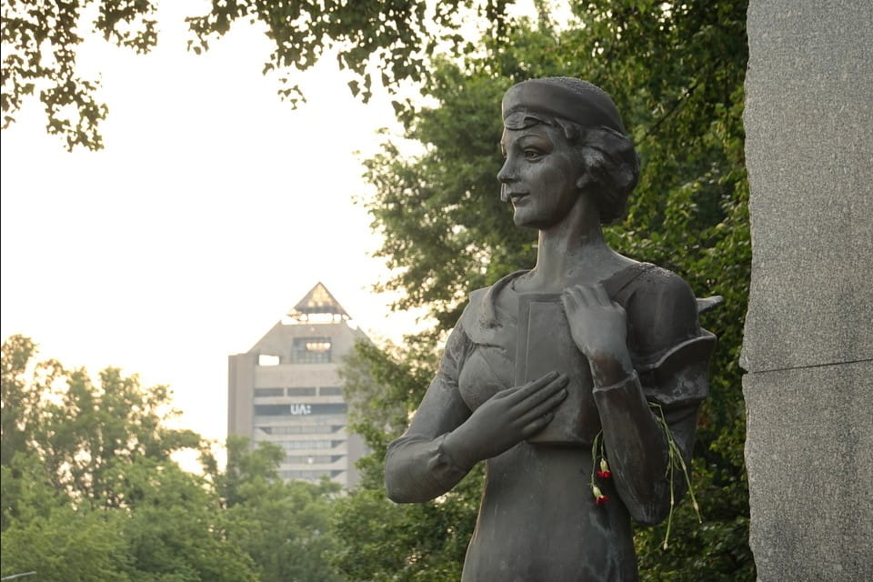
THE «ROAD OF DEATH» SIGN ON MELNIKOVA STREET: THE ROUTE OF KYIV’S JEWS TO BABI YAR, 29 SEPTEMBER 1941
On June 29, 1941, exactly one week after the outbreak of the war, the radio sets across the Soviet Union warmed the hearts of the 195 million citizens with a new patriotic song: ‘On June twenty-two, at four o’clock in the morning, Kyiv was bombed, and we were informed that the war had begun’. Sticking with the facts, the very first air bombs struck the major city of Ukraine just before 7 a.m. On the following day (June 23), nothing less than 200 000 male Kyivans were ordered for mobilization. The mass exodus from Kyiv would soon (September 29, the premier day of the ‘June 22’ song) advance with an order for the evacuation of the strategic enterprises to the heartlands and as a result the departure of dozens of thousands of citizens Eastward. All while the actual siege of Kyiv would be enacted as soon as July 11, the very first week of June of the war witnessed the massive defensive measures on a never-before-seen scale. Boundless groups of women, rare men, the elderly, and adolescents were now called to dig kilometers of ditches manually: an elusive obstacle to slowing down the unprecedented war machine of the Third Reich on its way to Kyiv.
Among the kilometers of such anti-tank ditches outside and inside the city, the one perpendicular to Melnikova Street (opposite the modern INSTITUTE OF INTERNATIONAL RELATIONS) looked like a barricade of the times of the French Revolution: with bags of sand and barbed wire next to a trench. From the early hours of September 29, 1941, thousands of Kyiv Jews had a few alternatives rather than following the order, which had been previously put on the walls and fences across the city and stimulated with the well-advised rumors about evacuation: a phantom hope for the future. In these early hours, the streets of the historical neighborhood of LUKYANIVKA (traditionally Ukrainian-spelled) next to the Artem factory and the local market were crowded with people. A woeful procession of women, the elderly, children, and sick people was on its move lengthwise Melnikova Street in the northwest direction. The unknown authors of the published banners (produced at the printed works of the Wehrmacht 6th army two days before) mishandled the topography of Kyiv by referring to an assembly point as a site close to the cemeteries, in fact, Apr. 2 kilometers away.

Although the printed order had prescribed 8 a.m., a vast number of people reached the site earlier. The onward movement of the endless column toward the cemeteries was snail-paced considering the crowded Melnikova street, the carriages, and a great number of old and sick people. Approximately 1300 meters further to the North-West (regarding an assembly point next to the Artem plant and the Lukyanivka market), Melnikova Street is crossed (indeed, it originates here to the East) by Yemelyan Pugachev Street. It was named after Don Cossack of the 18th century, a leader of the peasant rebellion of his times, who failed to conquer Tsaritsyn, later named Stalingrad, the upcoming grave of the German 6th army, which was now conquerors of Kyiv. Yemelyan Pugachev Street would preserve some of the historical buildings after the war. For example, №12 (today: National Academy for Public Administration under the President of Ukraine) would accommodate an orphanage for children who lost their parents at war or were liberated from the concentration and work camps.

To the immediate rear of this crossing with Yemelyan Pugachev Street, a few dozen meters further, the woebegone column of fated people could now witness the armed soldiers. The Germans took advantage of the never-used anti-tank ditch, bags of sand, and barbed wire as an improvised barrier and enclosure. In the first instance, people were ordered to leave the carriages, and those not Jewish were abandoned to cross the enclosure. From the accounts of the eyewitnesses, the absolute majority of the people who crossed this barrier perpendicular to Melnikova Street would not be allowed to go back. From this point, large groups of people were escorted further ahead of Melnikova up to the next enclosure in the intersection with Kagatna (modern Hohlov family street), short of the entrance to the Jewish Cemetery. The cross-examination of the eyewitness accounts represents the fact that the first barrier next to Yemelyan Pugachev Street would be used by the Germans until October 2, well beyond the conventional September 29-30 dates. The procedure would remain the same: the barrier separated the doomed persons from the on-goers.
The terrain itself played a role in the events of September 1941. The area between Melnikova Street and the upper spur of the Babi Yar (Babyn Yar) ravine is not uniform ground. The shallow depression running northwest from the junction with Yemelyan Pugachev Street — informally known among Kyiv historians as the Melnikova ravine (Melnikivskyi yar) — was one of the smaller offshoots of the Babyn Yar ravine system, which extended across much of this part of Lukyanivka. Several tributary ravines branched from the main Babi Yar site: the Babushka (Babusy) ravine to the north-west, the Repyakhova ravine to the east (near the former Jewish cemetery), and the Dорогожицький (Dorogozhytskyi) ravine along the route of the modern Dorohozhychi Street. The Melnikova ravine formed a natural depression in the terrain between the street and the main ravine, used by the Germans to conceal their operations from the surrounding residential area. In the post-war decades, this depression was levelled and built over. The anti-tank ditch dug in the summer of 1941, perpendicular to Melnikova (at the location of the modern Road of Death memorial sign), took advantage of exactly this topography. The roads out of Kyiv led to more than one killing ground. Across the river, Soviet prisoners of war were dying in their tens of thousands at Stalag 339 in Darnytsia.
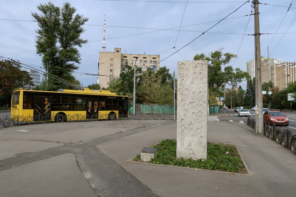
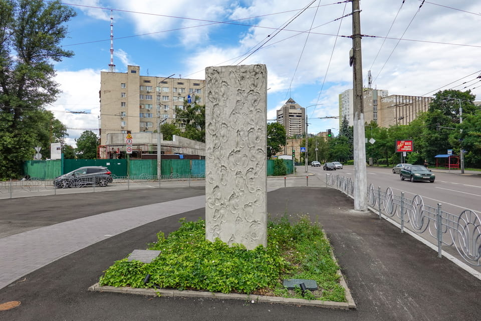

On October 3, 2011, seventy years after the dramatic events in the spur of Babyn Yar ravine in Kyiv, thousands of people, both Kyivans and guests of the capital of the now independent state of Ukraine, reunited to commemorate the memory of the victims of the Holocaust. This year was distinguished by the inauguration of a memorial, known at present as the ROAD OF DEATH sign. Approximately at 11 a.m., the granite stone of 2.5-meter height was unveiled within a concrete patch of land inside a service trolley bus traffic circle and became a part of the history of the Babyn Yar tragedy. The memorial was put approximately 150 meters from the first SS enclosure on Melnikova (modern Yuri Illenko). While the direct passage lengthwise Dorogozhitska Street is the shortest way to Babi Yar, the Germans orchestrated an alternative route further ahead of Melnikova Street. The front side of the monument is covered with symbolic imprints of human feet, commemorating the final path for the victims of the Babyn Yar massacre. A separate plate of black marble includes an inscription:
“Here starts the “Road of Death”, along which the fascist occupiers drove the Jews to be shot at Babyn Yar on September 29, 1941”

THE LUKYANIVSKE JEWISH CEMETERY ON MELNIKOVA STREET (1894–1960s): HISTORY, AKTION 1005 AND SOVIET DESTRUCTION

In 1886, Evsey Avraamovich Tsukerman, the rabbi of Kyiv (who would be re-elected in the course of the four decades), addressed the city authorities with an appeal to allot land for a new Jewish cemetery. As the initially prescribed plot of land next to Zverinets cemetery (originated from the XVIII century) was appreciated as two small plots, as early as 1888, the city council allocated a new, larger one. This new plot of land, initially authorized as 3 to 5 hectares, was chosen in Syrets, geographically squeezed between two existing cemeteries: Kirilovske of the XVIII century and Lukyanivske Orthodox (officially dating from 1878). The same written resolution allocated another spot for land nearby for the creation of the Karaim cemetery, which would be included in the maps of Kyiv as early as 1902, along the western border of the Jewish cemetery. A decision to establish a Jewish cemetery in this very part of Kyiv was dictated by the historical demography of the city (similar to the practice in Poland, for example, with the Old Jewish cemetery in the Podgorze district in Krakow). The surrounding neighborhoods had been historically a place of residents of the great majority of the Kyiv Jews.

Time passed by, yet a masterminded project of the cemetery, including the building of the funeral parlor (preserved until today), was not materialized without a patronship on behalf of the Jewish community of Kyiv. A new Lukyanivske Jewish cemetery was officially inaugurated as early as 1894. By the early XX century, the territory of a newly established burial place had substantially expanded and amounted to nearly 25 hectares in 1937, a year after it was closed for burial. By the time of the German occupation of Kyiv in September 1941, the Jewish Cemetery was neighbored by the overgrown Karaim cemetery with its territory of 2 hectares. Father to the West, beyond Karaim cemetery and next to the spurs of Babyn Yar, the ‘Mohammedan’ or ‘Muslim’ or Tataric’ cemetery of another two hectares had been used to shape the area. From this place, several eyewitnesses bore testimonies, among other viewpoints around Babyn Yar, about the mass executions of Jews within the upper spurs of the ravine.
The New Lukyanivske Jewish Cemetery would come in the dramatic eyewitness accounts of those who survived, as well as the locals and ongoers within the Babi Yar area. On September 27, two days before the mass action, several lorries used to pass beside the Jewish cemetery to deliver Soviet prisoners of war, male Jews in particular, to the upper spurs of the Babi Yar (Babyn Yar) ravine. As the mass action of September 29-30 materialized (in fact, the route and the SS barricades would be used until October 2 with the same organizational agenda), the ‘death road’ included a section of Melnikova Street beside the Southern wall of the Jewish cemetery. The Germans set the second (the first one was located at the intersection with Yemelyan Pugachev Street) improvised enclosure perpendicular to Melnikova between the corner of Kagatna (the modern Hohlov family) and the main entrance to the now-closed Jewish cemetery.

As late as August-September 1943, during the infamous ‘Aktion 1005’ (a euphemism for removing traces of mass murder), the Germans would force the inmates of the Syrets concentration camp to demolish many gravestones and sections of a metal fence of the Jewish cemetery to set on the improvised furnaces for burning corpses (buried within Babi Yar ravine) open air. These weeks marked the beginning of the liquidation of the Lukyanivske Jewish cemetery, which had been closed for burial since 1937 after forty-three years of operation, although the last graves were dated 1941. For a few years after the end of the war, one could see the remnants of the gravestones in the adjustment spur of the Babyn Yar ravine. Along with that, the burials would resume with the liberation of Kyiv and continue until the end of the 1940s. A new general plan for the development of Kyiv called for the liquidation of the territories of all three cemeteries (Jewish/Karaim/Mohammedan) and the reshaping of the area into a recreation park; however, the final judgment would be authorized as late as 1962.

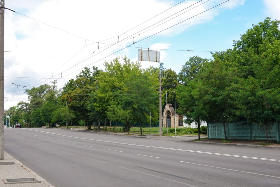
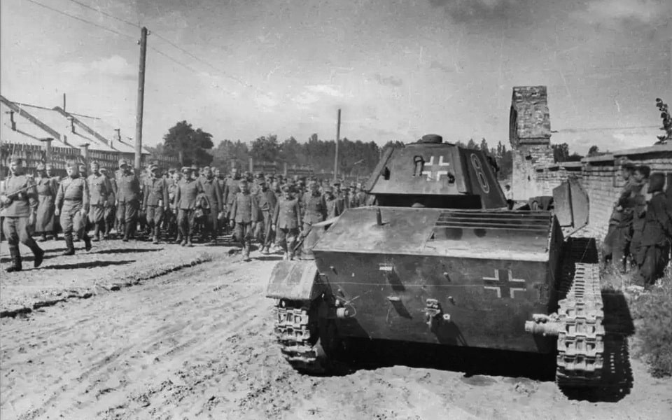
The final prescription for the urban development of the area integrated two separate cemeteries into one Jewish-Karaim, the one to be liquidated. The 1962 document included a passage that the major part of the burials had already been annihilated during the German occupation of Kyiv: only a half-truth, yet a satisfactory argument to liquidate the burial grounds. The combined territory of the two cemeteries was evaluated as 26.9 hectares (including Apr. 25 for Jewish and 2 for Karaim), the condition as a ‘wasteland’, overgrown with bushes and trees. Regardless of the mass slaughtering of the Jewish population of Kyiv (those who were not evacuated upon German arrival) between 1941 and 1943, the post-war returnees resumed visiting the burials of their relatives within the Jewish cemetery. Admittedly, the practice of annihilation of the Jewish cemeteries, in particular, was a common practice throughout the Soviet Union up until the fall of Communism. On the heels of the official document, the former final resting place for dozens of thousands of people was ‘entrusted’ to the competency of the ‘Department of the Urban Garden’ of Kyiv.

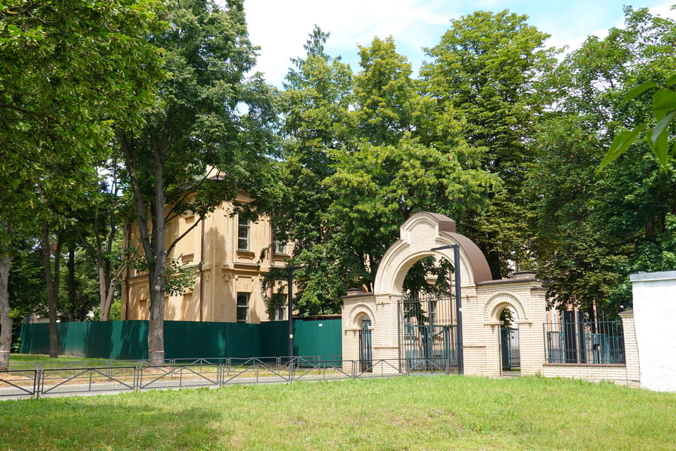
While the inks on the documents were still warm, the same 1962 witnessed an established project for a new Broadcasting complex, signed to occupy a part of the territory of the still-existing Jewish cemetery to the North of Melnikova Street. Another plot of land was demarcated for the sake of a planned sports complex with a swimming pool. The document included a passage on the ‘high density of the burials’ within the territory of the upcoming building, an ‘interference’ authorized to be liquidated. The following decade witnessed a progressive annihilation of the Jewish, Karaim, and the remnants of the Islamic cemeteries. The former green spaces are subjected to slashing, old erections for demolition, and tombstones for leveling with the ground. A new sports complex incrementally dominates the area, and the territory of the old war cemetery (to the west of the modern one) is leveled to free space for a new TV tower 385 meters high: the tallest erection in Ukraine.


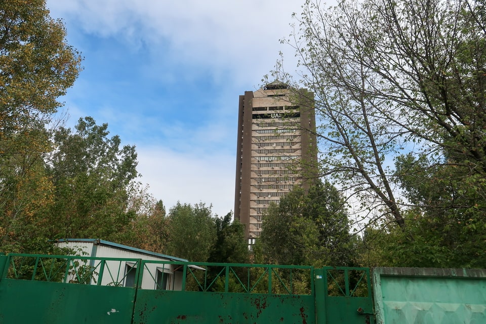
Bypassing the all but complete annihilation of the Lukyanivske cemetery in the course of the 1960-1970s, one erection survived both Nazis and Communists. The former administration building of the cemetery has been preserved until today at Yuri Illenko 44 (former Melnikova). The construction blueprint of the building, accompanied by the cemetery itself, the fence, and the main gate, was submitted for approval as far back in history as 1892. The greater part of the construction works demanded another two years. Half a century from that time, in August-September 1943, the building was occupied by the operational staff of the sadly remembered ‘1005’ unit, in charge of eliminating the traces of mass crimes in Babi Yar. All while the involved inmates of the Syrets concentration camp were kept in locked dugouts in the ravine and inside another dugout in Syrets camp, the Germans from among the ‘Ordnungspolizei (Order police)’ made themselves comfortable inside the former cemetery administration building. After the war, the Kyiv city authorities shied away from wasting the property, and the building was turned into a dormitory for the players of the ‘Sokol’ hockey team.

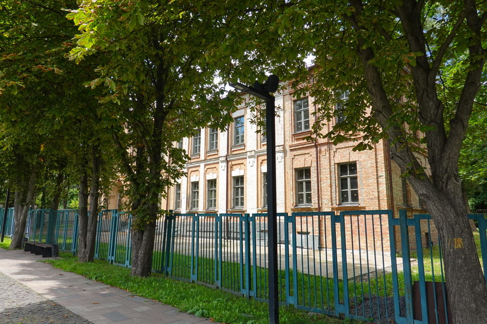
As decades passed by, the memory of the Babi Yar victims has been gradually making headway into the public perception of a new independent Ukrainian state. As early as 2016, three-quarters of a century after the German occupation and mass executions in Babi Yar and Syrets camp, the Lukyanivske Jewish cemetery made its history felt once again. A ‘ROAD OF SORROW’ was erected on the place of the former cemetery alley with recently excavated tombstones, brought here from the spurs of the ‘Repyahov’ ravine nearby, cleaned, and partially repaired. At the same time, the Melnikova 44 (modern Yuri Illenko) building was transferred back into city ownership: initiated repair works now aimed to reshape the historical landmark into a memorial museum devoted to the memory of those killed in Babyn Yar.


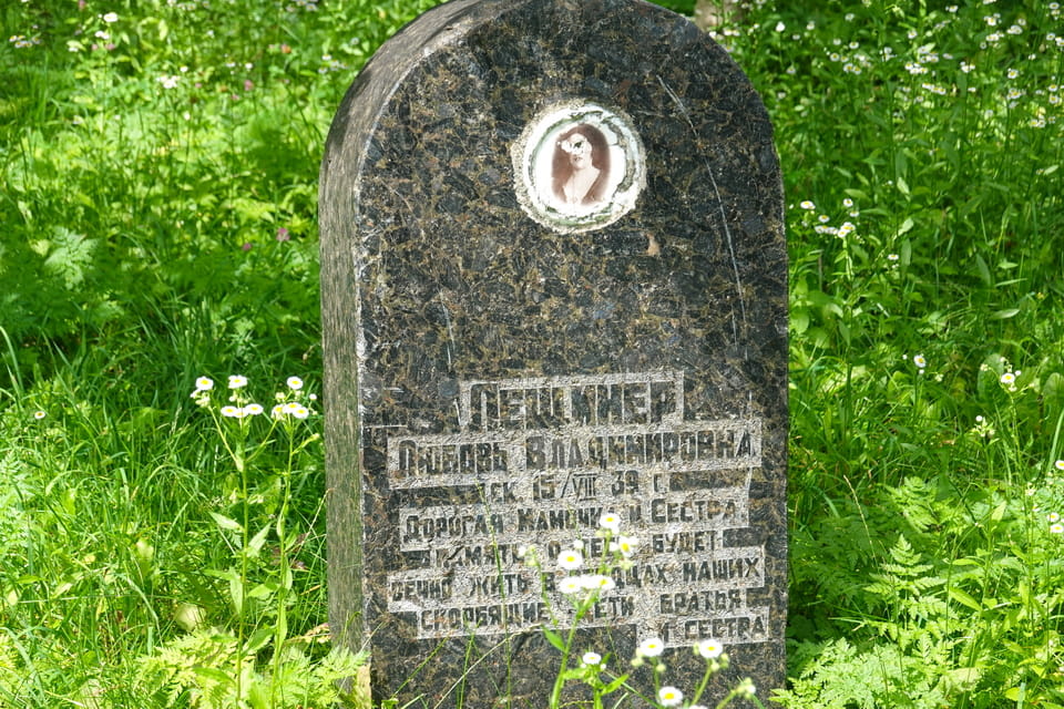
A shortlist of the preserved historical sights from the era includes a section of the authentic cemetery fence, as well as a tiny plot with burials, Apr. 100 meters distant from the Menorah memorial to the East. In the years to come, it is the territory of the former Jewish cemetery, which will make space for the construction of a grandiose Memorial center.


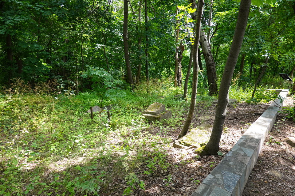
LUKYANIVSKE ORTHODOX CEMETERY (1878): NKVD MASS GRAVES, BABI YAR WITNESS AND MEMORIAL RESERVE TODAY
One of the oldest cemeteries in Kyiv (Cyrilivske cemetery dates back as far as the XVIII century, yet is almost annihilated today) originates from the last quarter of the XIX century. Toward the year 1878, when the Kyiv city officials assigned a plot of land of 3 hectares, squeezed in between two historical districts: Kurenivka and Lukyanivka, not abundant burials had been carried out in the course of the previous seven years. Those pioneer resting places were made for the deceased patients of Cyril’s hospital, afterward named Pavlov Mental Clinic, and sadly remembered as part of the tragedy in Babi Yar. The very first decade of the cemetery operation witnessed the erection of a cozy wooden chapel (1887), later in 1910, followed by a stone church of St. Catherine (which was demolished in the 1970s), which was the main place for the liturgy. The Lukyanivske cemetery was created as the main site for burials in Kyiv at that time. The terrain of the site would be steadily expanded towards the fall of the Tsarist monarchy, and numbered as many as 30,000 burials and 20 hectares on the heels of the Great War. While the Lukyanivske cemetery was initially established as an Orthodox resting place, at varying times, the representatives of many religions and nationalities found their tombs there. The year 1915 witnessed the separation of a stand-alone section for Catholics in the Orthodox cemetery. Regardless of the ever-growing Jewish cemetery nearby, some Jews found their last resting place within this Christian one.
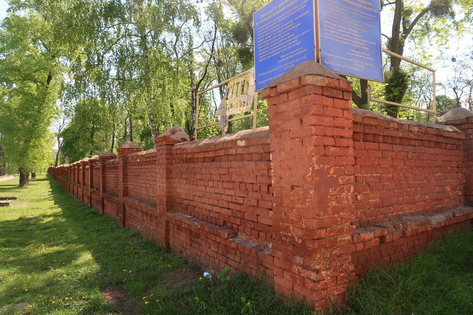
As far back as the Tsarist era, another section of land was assigned for the burials of inmates from Cyril’s prison, a historical detention center, which had been expanding since the 1860s, next to the Lukyanivka market (both to the West of the September 29 assembly point). As late as 1918, the Bolsheviks carried out tortures and mass executions of their political enemies within Cyril’s prison and used to bury bodies in mass graves at the Lukyanivske cemetery, later neighbored by the victims of ‘Holodomor’, a 1932-1933 man-made famine orchestrated by the Communist regime. The years of ‘The Great Terror’ or ‘Red Terror’ in 1937-1938 witnessed another dramatic chapter of history with mass executions on a never-before-seen scale in Kyiv and unmarked burials, at the Lukyanivske cemetery in particular. At that time, the personnel of the cemetery was put under the supervision of the infamous Soviet NKVD, and the locals would later testify to the existence of the mass graves within the spurs on the periphery.


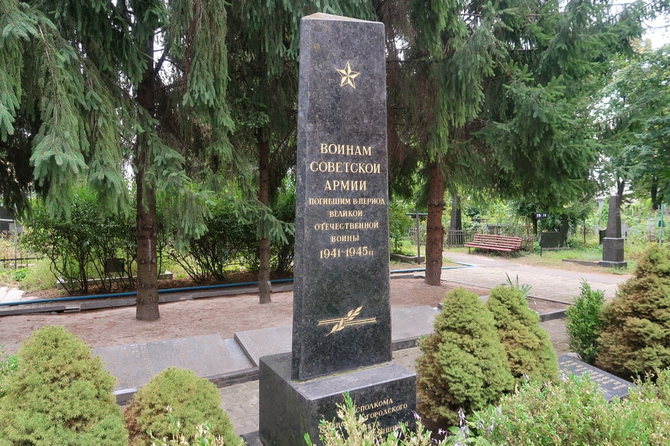
In the course of the infamous mass killing action on September 29-30, 1941, and within the subsequent days (the first wave of executions lasted until October 2-3), the route of the doomed Jews actually besided the Northern wall of the Lukyanivske orthodox cemetery. The cemetery was cordoned off by the brick wall (which exists today) in the 1920s. Next to an intersection with Kagatna (modern Hohlov family), the columns of people were forced to move forward lengthwise along Dorogozhitska Street toward the upper spurs of the Babi Yar ravine. Approximately to the northeast corner of the cemetery, the Germans used an open site next to the former tank repair garages to take possession of valuables, clothes, and documents from their victims. At this very place, an intersection with Kagatna (modern Hohlov family) further South was barricaded with another enclosure with German soldiers. Several eyewitnesses watched the mass killings in Babi Yar ravine straightforwardly from the territory of the Orthodox cemetery, from the windows of a gatehouse in particular. The Western border of the cemetery at that time neighbored an anti-tank ditch, another site for mass executions in the course of the German occupation of Kyiv in 1941-1943. The cemetery itself witnessed mass executions. An episode of the killing of 400 people would later be investigated by the Special State Commission. The modern cemetery, which has been officially closed for burials since 1962, bears the status of a memorial: THE LUKYANIVKA STATE HISTORICAL AND MEMORIAL RESERVE, has a small museum near the entrance, and provides excursions across forty-five historical sections of the territory. Kyiv’s wartime burial geography has a German chapter too. The Wehrmacht dead of 1941–1943 were gathered decades later into a single war cemetery at Vita-Poshtova, south-west of the city.


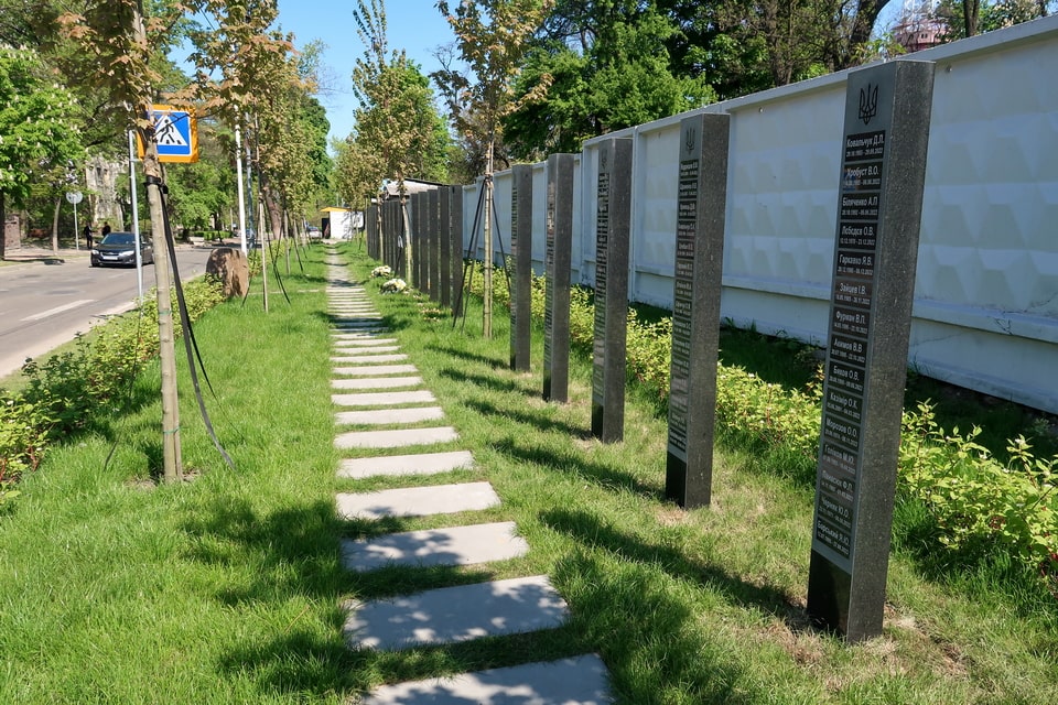

ANTI-TANK DITCH ON DOROGOZHITSKA STREET (FORMER LAGERNA): BABUSHKA RAVINE AREA AND 25,000 VICTIMS (1941–1943)
As Kyiv experienced a wide-sweeping exodus of its population both to the East and to the ranks of the Red Army, the greater majority of the remaining civilians were occupied with defensive measures to make the Ukrainian capital into a fortress. The period between June 22 (the outbreak of war) and September 19 (the start of the German occupation) witnessed a dig-out of roughly 30 kilometers of anti-tank ditches in the immediate vicinity and within the city borders. The exhaustive manual work was intensified after July 11 during the siege of Kyiv. The streets of the city are now lined with hundreds of improvised barricades, very similar to those of the times of the European revolutions of the 18th-19th centuries. Apart from the ditches, conventionally up to three meters in width and depth, Kyivans used sandbags, barbed wire (30 kilometers in total), anti-tank hedgehogs, wood boards, barrels, and even furniture. The defensive act of bravery would be a ‘Sisyphean labor’, as the Germans would enter Kyiv with little resistance. The civilians would be forced to demolish the barricades, which had been erected in the course of the previous three months.

One among such anti-tank ditches dug out in parallel to Lagerna (modern Dorogozhitska) street, originating from the North-West corner of the Lukyanivske Orthodox Cemetery and going out to the Syrets military camps (in 1942, the Germans would set up a concentration camp within the site). A wide range of testimonies about Babi Yar and Syrets concentration camp, including the ones voiced at the Nuremberg trials, included recollections about this very anti-tank ditch as a mass execution and burial site. In wider terms, a defensive erection, set up to defend the civilian population from the advancing enemy army, would become a place for mass killings and a large mass grave for the Soviet POWs and civilians.
All while the upper spurs of the Babyn Yar ravine, including a large sand quarry more than half a kilometer in total, were to become the primary site of the mass executions in September-October 1941, the two years to come brought several local sites of the same origin. Whereas the shootings and gassing of the patients of the Pavlov Mental Clinic were local in their dramatic nature, the anti-tank ditch lengthwise Lagerna (modern Dorogozhitska) was to become the major killing site in 1941-1943. The very first winter of occupation witnessed the bringing, thus execution and burial on a mass scale) of the inmates of SD prison at Korolenko 33 (modern Volodymyrska street), set by the Germans in the former NKVD building, a mass execution site under the Communists. As late as February 1942, the ditch would become the last resting place of some Soviet marines, captured by the Germans in September 1941. With the end of the operation of the Syrets concentration camp, an anti-tank ditch close to its borders would become the primary site for executions apart from Babi Yar itself.

The key testimonies regarding the anti-tank ditch along the length of Lagerna (modern Dorogozhitska) conventionally render three sources. 1) after-war accounts of the former inmates of the Syrets concentration camp; 2) the German wardens on the site; 3) the documents of the Special State Commission on Investigating the Crimes. In two years of occupation, this anti-tank ditch will ‘absorb’ the Soviet POWs, the members of the Communist Party, and Jews, in particular, the members of the Ukrainian patriotic nationalistic formations, the members of the underground and partisans, the inmates of the prisons, and civilians en masse. During the infamous ‘Aktion 1005’ on exhumation and burning of the corpses in 1943, the ditch was to become one of two main sites of the ‘works’, the one apart from the upper spurs of the Babi Yar ravine itself. The eyewitnesses testified on the exhumation of up to 20,000 corpses, some of which still retained military insignia. The State Commission would later document 25,000 dead, summing up the ditch itself and the victims of the Syrets concentration camp to the North-West.
The exhumated mass of corpses included wounded Soviet POWs, some of them with pairs of crutches. A share of the victims was identified as male Jews and political officers: two categories of prisoners, assigned to immediate execution. Apart from the military men, the investigation factualized a great number of civilians, including women and children. As for the exact dimensions of the anti-tank ditch, the eyewitnesses testified to a variety of figures from 200 to 300 meters in length and 3 to 5 meters in width and depth. As late as August 1943, some SYRETS CAMP inmates, groups of up to 80 men, were taken from the camp daily to perform an exhumation of corpses, in parallel with the same process in Babi Yar ravine itself. One of the improvised furnaces for burning corpses was erected close to the anti-tank ditch itself, and the German officers supervised both locations. After the escape of the inmates, engaged in ‘Aktion 1005’, the remaining 300 men would be shot on the site of their recent work and committed to the flames they had set themselves.

MEMORIAL SIGN TO SYRETS CONCENTRATION CAMP: LOCATION, «AKTION 1005» (1943) AND THE PRISONERS’ ESCAPE
Back in spring 1941, at the time when ‘Weisung Nr. 21’ (directive on Operation Barbarossa) was being updated with vivid writing inks on refining documents, the Germans authorized a blueprint for setting up a system of camps within the still-to-be-conquered territories of the Soviet Union. This new detention chain was expected to perform custody for the POWs and their families, as well as ‘political suspects’, an upcoming euphemism with almost never-ceasing interpretations. The Syrets concentration camp, set up by the Germans in Spring 1942 on the site of the former ‘Syrets military camps’, was to become such a ‘detention center’. Similar to the old Polish military camps in the city of Oswiecim, the Germans took advantage of the existing site and infrastructure, yet widely expanded in the course of operation. Some erections dating back to the 19th century were demolished to make room for new watchtowers, wooden barracks, and dug-out barracks. The vast territory to the West of the Babi Yar ravine was now fenced with two rows of barbed wire, including the electrified enclosure. The camp was divided into a working area and a residential zone: the latter divided into a ‘men’s’ and ‘women’s’ camp.


The daily working routine of the inmates of the Syrets concentration camp was deadly exhaustive and mirrored the Nazi approach to such kind of facilities and the mass exploitation of human lives within the conquered ‘Lebensraum’ (‘Living space’ in the violent Nazi worldview). Alongside hard work from 5 a.m. until 9 p.m. and malnutrition, the prisoners were exposed to beatings and constant humiliation, and any insubordination meant punishment: conventional death. The investigation of the operation of the Syrets camps soon after the liberation of Kyiv in 1943, including the exhumation of corpses, would allow us to factually establish that predominantly the death of the inmates stemmed from violence. Toward the end of the 1940s, the former German concentration camp would be reshaped to hold in detention the German POWS, captured during the liberation of Ukraine. A number of them were buried nearby, within a small German military cemetery, next to the modern Syretz metro station to the West.


As early as the 1960s, along with the liquidation of the Jewish cemetery and fundamental reshaping of the area, the remnants of the former camp were annihilated to make space for a new residential quarter predominantly with five-story buildings. It was not until 1991 that a ‘Memorial sign to Syrets concentration camp prisoners’ would be erected at the crossroad of the former Lagerna (modern Dorogozhitska) and Shamrylo (modern Parkovo-Syretska) to the South of the actual site of the former concentration camp. The shadow figures of the prisoners and a metal bar are accompanied by a metal plate:
“On this spot during the German-fascist occupation behind lattices of Syrets camp, tens of thousands Soviet patriots were tortured to death”


PAVLOV MENTAL CLINIC (CYRIL’S HOSPITAL), KYIV: 752 PATIENTS KILLED BY NAZIS IN 1941–1942 — GASWAGEN AND SHOOTING
The history of the area in the weald above the Dnipro river, the location of the ‘Kyiv City Mental Clinic №1 after Pavlov’, harks back to the 12th century. In 1140, Cyril’s monastery was founded here to give life to a brick church, the future tombs of the Kyivan sovereign, dominating the landscape. It would take another hundred years until the area of ‘Syrets’, including the monastery, would be mentioned on paper as a gift to Kyiv-Pecherska Lavra in Kyiv, the iconic Christian monument of the Slavic world. In the same year of 1240, Kyiv was captured, looted, and partially destroyed by the Mongolian tribes: the fate dramatically affected Cyril’s monastery. Three more centuries would pass until Syrets would be incorporated into the city limits of Kyiv (as a suburb, in fact) and vast territories would be added to the area of the monastery on the hill over Dnipro. Along with that, an area over the Babi Yar ravine and a river valley would be a rarely populated exurban periphery of the city.
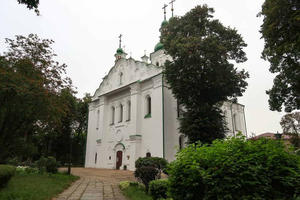
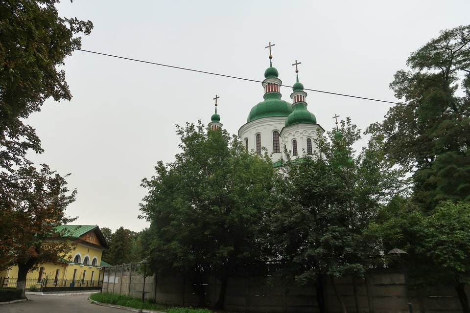
In 1784, the six-century history of Cyril’s monastery and the church came to a close. At one time, with the setting up of Cyril’s cemetery to the South (which does not exist today), in 1786, the former prayer place and a cradle of Kyivan princes was turned into a home for disabled war veterans. The inspiration came from different corners of Europe, including, of course, Paris with its famous Hôtel des Invalides, which had been operating since the 17th century. As early as 1803, the newly built wooden buildings on the territory were accommodated (moved here from the so-called ‘House of Petr I’ in the Podol area of Kyiv) by the so-called ‘House of correction’: a euphemism for a home for mental disabilities and drunkards. Initially supposed to allocate only 25 patients, this new division was destined to be expanded: with new wooden and brick buildings of one and two stories. A laundry (which exists today) was built in 1823.

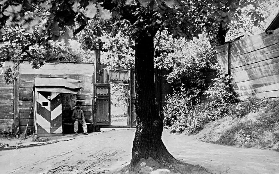
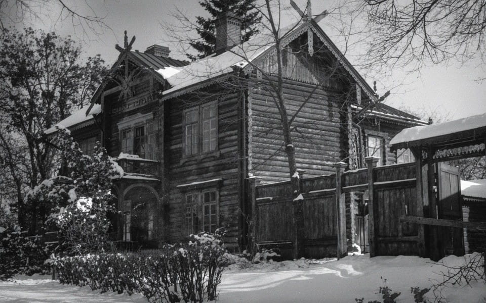


In 1891, Cyril’s Hospital (called at that time), which had long ago surpassed the status of a hospital for war veterans (a disabled person’s home had been closed in 1835 and its facilities entrusted to a hospital), witnessed the building-up of a two-story therapeutic unit for 32 beds and another one in six years. As early as 1902, the hospital had the right to boast of a new infectious disease department for 60 beds: the event was soon followed by the erection of several new brick buildings, including a chapel with a mortuary (1902) and the obstetric clinic of the Women’s Medical Institute (built in 1913). In the course of the Great War (WWI), the clinic was converted into a military hospital. Already in 1920, Cyril’s clinic was fated to bear the name of the iconic Taras Shevchenko, a Ukrainian poet of the 19th century, until 1936, and was named Pavlov Mental Clinic. The Soviet physiologist, the awardee of the Nobel Prize, and the pioneer researcher of the higher nervous system, passed away in February 1936 at the age of 86. Toward the German occupation of Kyiv in 1941, the territory of the Pavlov Mental Clinic was enlarged to 20 hectares.

The Pavlov Clinic became a part of the tragic history of Babyn Yar on October 13, 1941. Three days before this date, the Germans informed the medical personnel of the planned evacuation of the Jewish patients, supposedly to an appropriate institution for mental disabilities in the Ukrainian city of Vinnytsia. The ‘evacuation’ naming kept the ‘Aktion’ on the annihilation of the mentally sick Jews in the dark. The two trucks brought 25 members of the SS as well as 30 soldiers of the ‘Ordnungspolizei’ (Order police) to the territory of the medical center above the spurs of Babyn Yar. The Jewish patients were flushed out of the brick building unit and then hastened with sticks toward the cliff of the ravine and a pit. The following procedure of the massacre mirrored the September 29-30 blueprint. The doomed people were forced to lie in the pit, layer by layer, to be shot. The action demanded the lives of 308 mentally deceased persons on that October day. In the following month, a German report on the ‘Aktion’ would include a passage on severe ‘emotional load’, which had been experienced by the executioners of the ‘evacuation’ in Pavlov clinic on 13.10.1941.

On January 8, 1942, the German punitive units resumed their presence in the medical center: this time to annihilate the remaining patients, regardless of their nationality, thus non-Jews. The executioners brought the infamous ‘Gaswagen’, which had been tested within the death camp Chelmno in Poland. The patients were now driven into a lorry with an enclosed body, and a subsequent operation of the engine asphyxiated people inside to death. On that January day, the Germans initially planned to bring two ‘gaswagens’ to the Pavlov Mental Clinic, yet the snowdrifts made it possible to deliver only one mobile killing facility to the site, which took the lives of Apr. 300 patients. The asphyxiated bodies were initially bulked within one of the premises until another lorry took them to the mass graves in the Babyn Yar ravine the next day. The Nazi mobile killing factory would visit the site two more times: in March and October 1942, to annihilate all remaining sick people. Along with these actions, an unknown number of Soviet POWs were executed in the bushes on the periphery of the medical center during the German occupation.

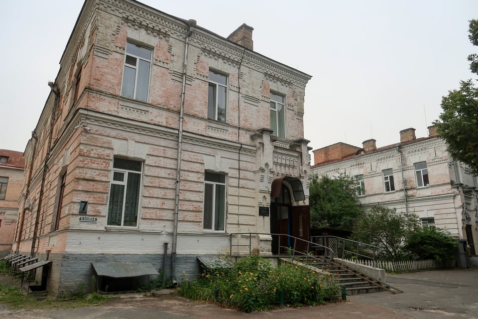
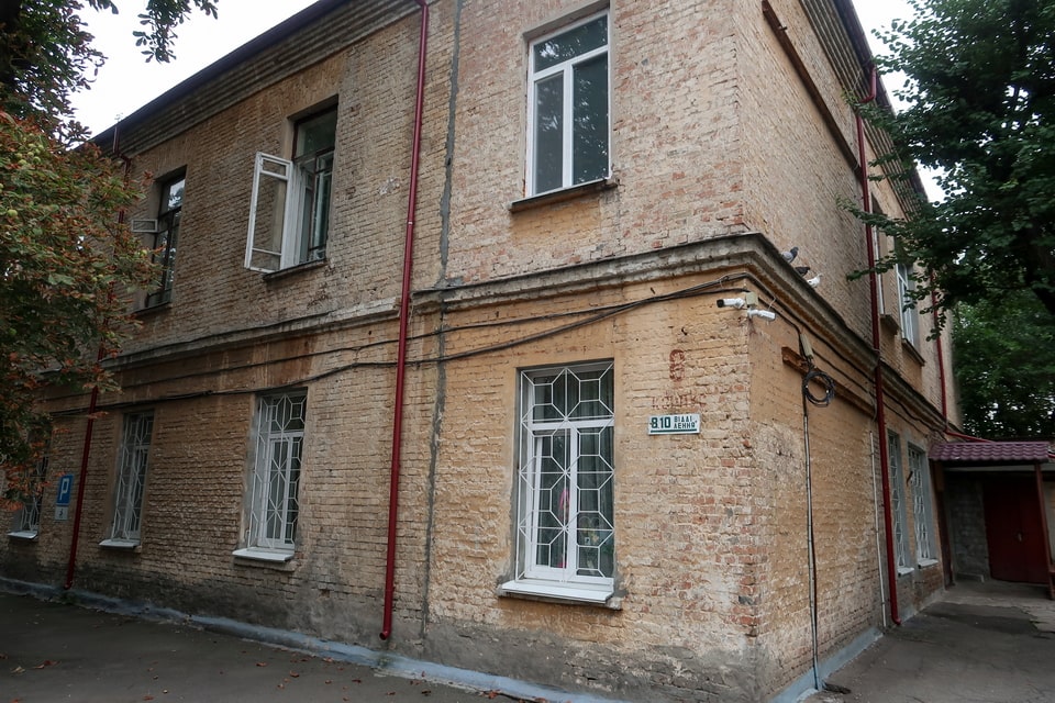

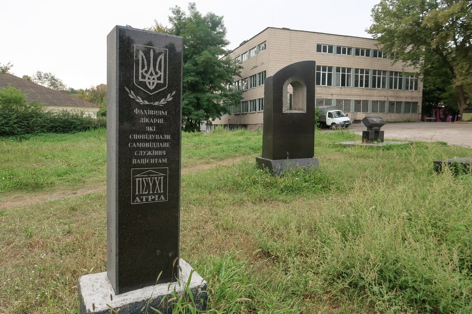
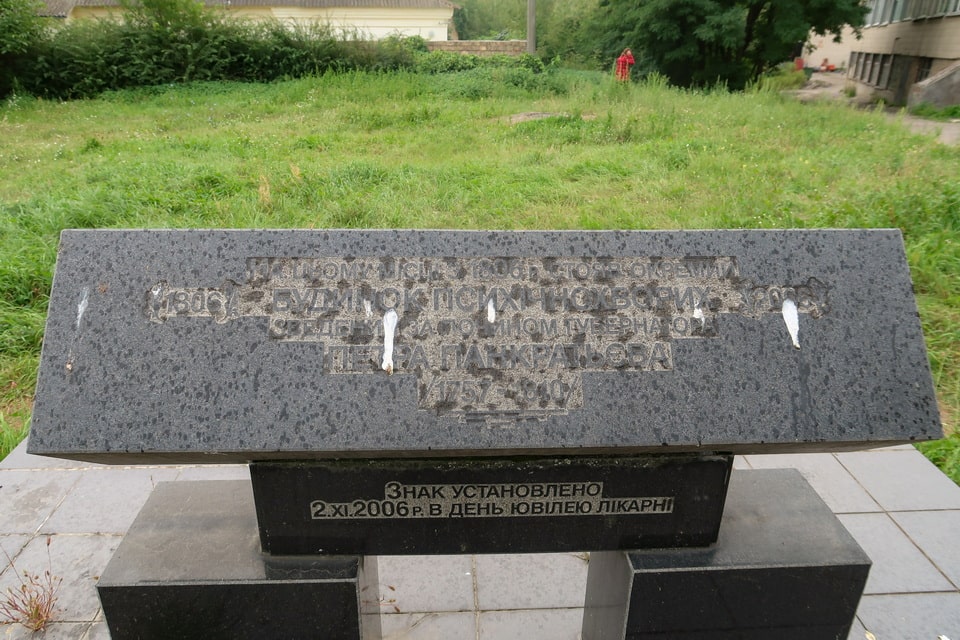
In August -September 1943, in the course of the infamous ‘Aktion 1005’, the Germans recalled the mass graves next to a mental clinic to include the site in the liquidation of the traces of crimes. Among other locations in Babyn Yar (Babi Yar), the prisoners of the SYrets concentration camp were taken to the territory of the Clinic and the nearby spurs. They exhumed up to 800 corpses, which would be taken and burned in the giant furnaces in Babi Yar. As the war ended, the Clinic resumed its specialized operation, and the 1960s witnessed the building up of most of the buildings, preserved until today. It was not until 2003 that the memory of the victims would be commemorated in a few memorial installations on the territory of the Medical Center. The inscription on one of these signs commemorated the figure of 752 killed patients, although the exact figure is still to be factualized. The inscription points out only the year 1941, yet the majority of the patients were killed in 1942.
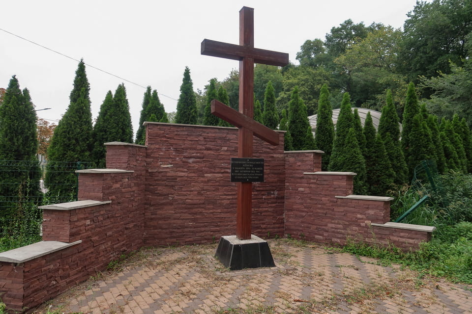
“In 1941 by the hands of Hitler occupiers 752 patients of psychiatric hospital were killed. We remember the innocent victims”

MEMORIAL SIGN TO DYNAMO KYIV FOOTBALL PLAYERS: «DEATH MATCH» (9 AUGUST 1942) AND SYRETS CAMP EXECUTIONS (1943)
The house-to-house drafting in the Red Army in June 1941 provided no immunity to Soviet sportsmen, including football players. As the guns around Kyiv went silent in September, a great proportion of the pre-war ‘DYNAMO’ team players had now descended to routine physical labor. As early as May 1942, the recently minted heedie of bread-baking production, a privileged Moravian ‘Volksdeutsche’, took on a number of the former football players and formed a team less than a month later. That summer, the newborn ‘Start’ team shared the grass with German and Hungarian soldiers, and German railmen, and the most prominent matches were arranged against the ‘Flakelf’ team on August 6 and 9, 1942. One was named after the legendary 88-mm air defense gun; the German team miserably lost 1:5 and 3:5 retrospectively. ‘Start team’ won every game of that summer series.
It was this August 9, 1942, game that would come into Soviet national reception as the ‘Death match’. The forged legend cultivated an idea that Ukrainian football players had decided to win the match regardless of the direct death threat. The issue of intimidation toward the ‘Start’ players is debateful as the surviving players later denied such a precondition. Along with that, the Ukrainian team participated in only one match after the ‘Death’ one, against a local team, and the subsequent games with German teams were suspended. In the following month, the larger half of the ‘Start’ team was arrested, interrogated in a local Gestapo prison, and some of them were released. Relatedly, several players were to become inmates of the Syrets concentration camp next to the Babyn Yar ravine.

From amongst the players, who had been kept in confinement in Syrets camp, three were fated to share the dramatic nature of the site. The post-war investigations, including the thirty-year-long court examination in Hamburg (conducted from 1972 to 2005) and the cross-examination of the testimonies of the surviving players as well as other inmates of the camp, all finally found no direct correlation between the results of the football games and the execution. The shooting of three players: Nikolai Trusevich, Ivan Kuzmenko, and Olexi Klimenko took place on February 24, 1943, more than six months after the August match with the ‘Flakelf’ team, on a personal commission of Sturmbannführer Paul Radomski, the commandant of the camp. The warden, who had been known for his cruelty and excessive drinking, was relieved from his post on the same day because of unsuitable behavior and threats toward his German subordinates.
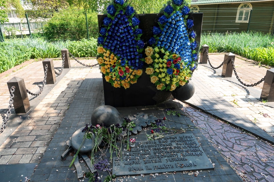
Towards the 1960s, when the territory of the former Syrets concentration camps was leveled to the ground to make space for a new residential quarter, construction workers used to reveal mass graves with the corpses of the former prisoners. One such grave was disclosed to the North of the actual campsite amid a building-up of a residential building on Grekova Street. The revealed collective grave included the remains of a man with soccer cleats: later identified as one among three killed football players of the ‘Start’. It was not until 1999, almost sixty years after the tragedy, that a small monument would commemorate the memory of the sportsmen. The inscription says:
“On this place during the German fascist occupation of Kyiv in 1941-1943 were executed war prisoners, the footballers of Kyiv “Dynamo” and Ukrainian civilians. Eternal Memory and Glory”


THE KURENIVKA DISASTER (13 MARCH 1961): HOW SOVIET CONSTRUCTION IN BABYN YAR BURIED A NEIGHBOURHOOD
The story of the Babyn Yar ravine did not end with liberation in 1943 or with the construction of memorials. It continued into the Soviet period with one of the most concealed disasters in Ukrainian history: the Kurenivka landslide of 13 March 1961.
During the late 1950s and early 1960s, Soviet authorities decided to rationalise the landscape of the Babi Yar (Babyn Yar) area. The central ravine — the massacre site — was to be filled in, disguised, and eventually converted into a park and housing development. To do this, a hydraulic filling operation was initiated: slurry (a liquid mixture of water and clay waste from a brick factory at Petrivka) was pumped into the ravine system through a pipeline, slowly filling the depressions. The dam retaining the slurry within the Babyn Yar area was a makeshift earthwork construction, subject to minimal engineering oversight.
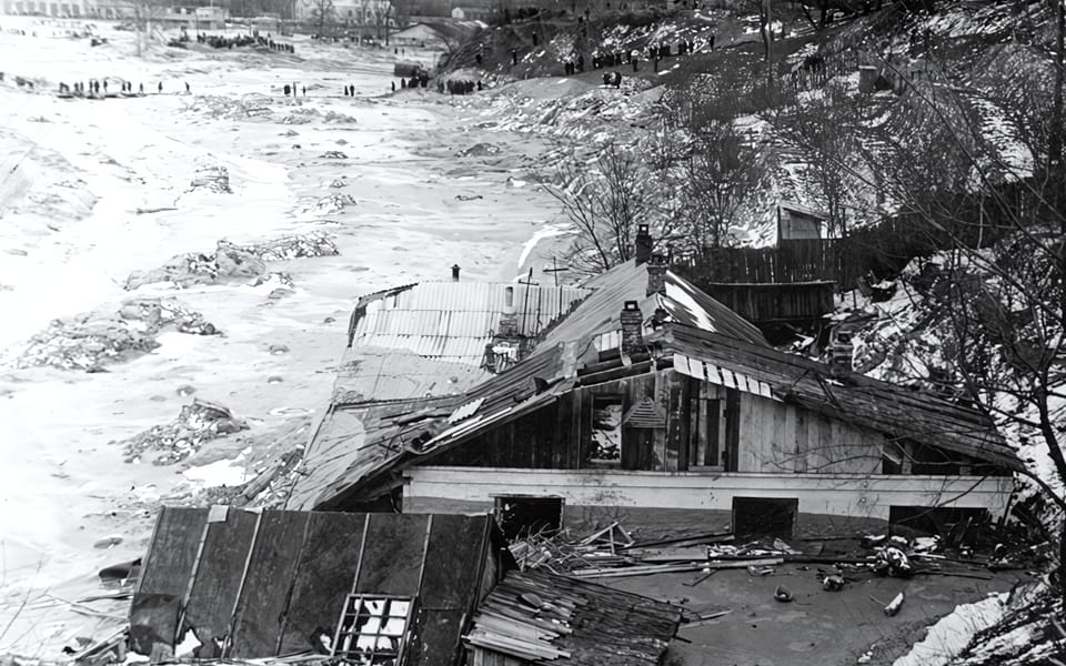
At approximately 8:30 a.m. on 13 March 1961, the dam collapsed. A wall of liquid mud, estimated at 14 metres high, burst through the retention barrier and flooded the Kurenivka neighbourhood below — a densely populated working-class district adjacent to the ravine. The flood engulfed a tram depot at the height of the morning rush hour, burying trams, passengers, and depot workers. The official Soviet death toll was reported as 145 people. Independent Soviet-era estimates and post-independence Ukrainian investigations suggest the true figure was between 1,500 and 2,000, with bodies buried in the mud and never recovered. The Soviet authorities suppressed all information about the disaster for decades. It was classified as a state secret. Witnesses were warned not to speak of it. The flood was the direct consequence of the decision to erase the Babyn Yar ravine — to bury a mass grave under mud and build over it. In this sense, the Kurenivka disaster is the last chapter of the Babyn Yar tragedy: the site of the Holocaust massacre claimed another wave of civilian lives through Soviet negligence and concealment.
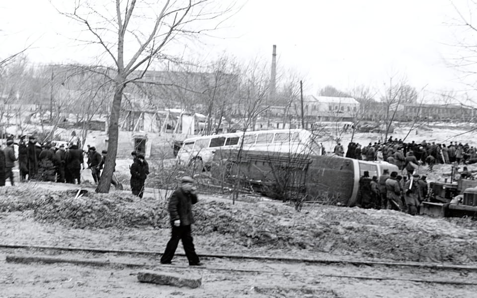
The Kurenivka neighbourhood today (Куренівка) still bears its historical name, a relic of the Jewish neighbourhood (Kurenivka camp) that pre-dated the 1941 occupation. The site of the former tram depot where many victims were killed is located approximately 1.5 kilometres north of the current Babyn Yar park, near the junction of Frunze and Petropavlivska streets.
WALKING THE BABYN YAR VICINITY: PRACTICAL GUIDE AND ROUTE FOR ALL 7 SITES
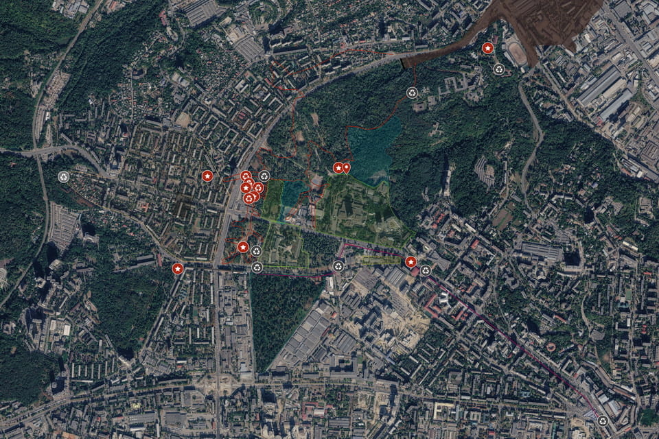
All seven sites described in this article can be visited on foot in a single walk of approximately 2.5–3 hours. The route is accessible year-round. Most sites are on public streets or in open areas — no admission is required.
Starting point: Dorohozhychi metro station (Line M3, Blue line), Kyiv. Exit toward Dorohozhytska Street.
Suggested order:
- «Road of Death» memorial sign — on Yuri Illenko Street (former Melnikova), in the service road of the trolleybus turning circle. ~15 min from the metro.
- Lukyanivske Jewish Cemetery remnants & Road of Sorrow — along Yuri Illenko Street.
- Lukyanivske Orthodox Cemetery — entrance from Dorohozhytska Street. Memorial Reserve with a small museum. ~10 min from #2.
- Anti-tank ditch (Dorogozhitska Street) — the modern pedestrian path along Dorohozhytska (former Lagerna) roughly follows the ditch line. ~5 min walk north from the cemetery.
- Syrets Camp memorial sign — junction of Dorohozhytska and Parkovo-Syretska. ~5 min walk from a previous location.
- Pavlov Mental Clinic (Cyril’s Hospital) — entrance on Cyril’s Street (Кирилівська). Memorial signs inside the territory. ~ 30 minutes walk or better use the trolley buses: №27, 30, 31, 50.
- Death Match memorial sign — on Hrekova Street (Грекова). ~10 min walk from the Syrets camp memorial sign.
The main Babyn Yar ravine and memorials are accessible from the Dorohozhychi station.
I am very grateful to war archives, museums, libraries, private collections, and writers for the historical photos in this article. To the extent that some author or a copyright owner may not want some of the above black-and-white photos to be used for educational purposes here, please contact me for adding credits or deleting the pictures from the article.