Umschlagplatz Warsaw: Deportation Site Then and now
The word Umschlagplatz — German for «transfer point», «assembly point», or «transhipment square» — entered history in the summer of 1942. Before that, it was simply the administrative designation for a freight terminal in the northern part of occupied Warsaw: a disused railway depot and loading area on Stawki Street, at the corner of Dzika Street, that had served as a goods handling point for the city’s supply infrastructure since the 1890s. Between 22 July and 21 September 1942, a period known as «Großaktion Warschau» (the Great Action), the Germans transformed it into the assembly and deportation area for the mass removal of Warsaw’s Jewish population.
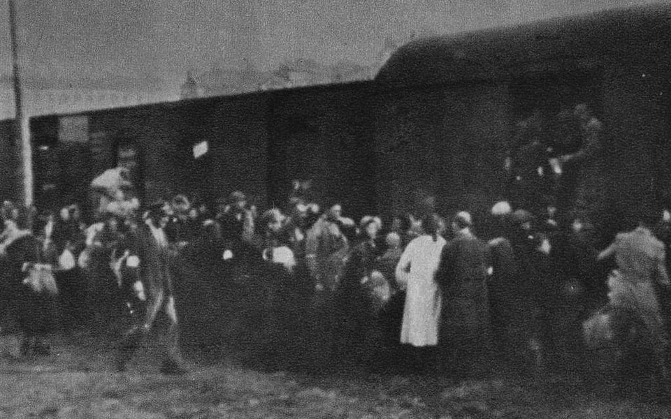
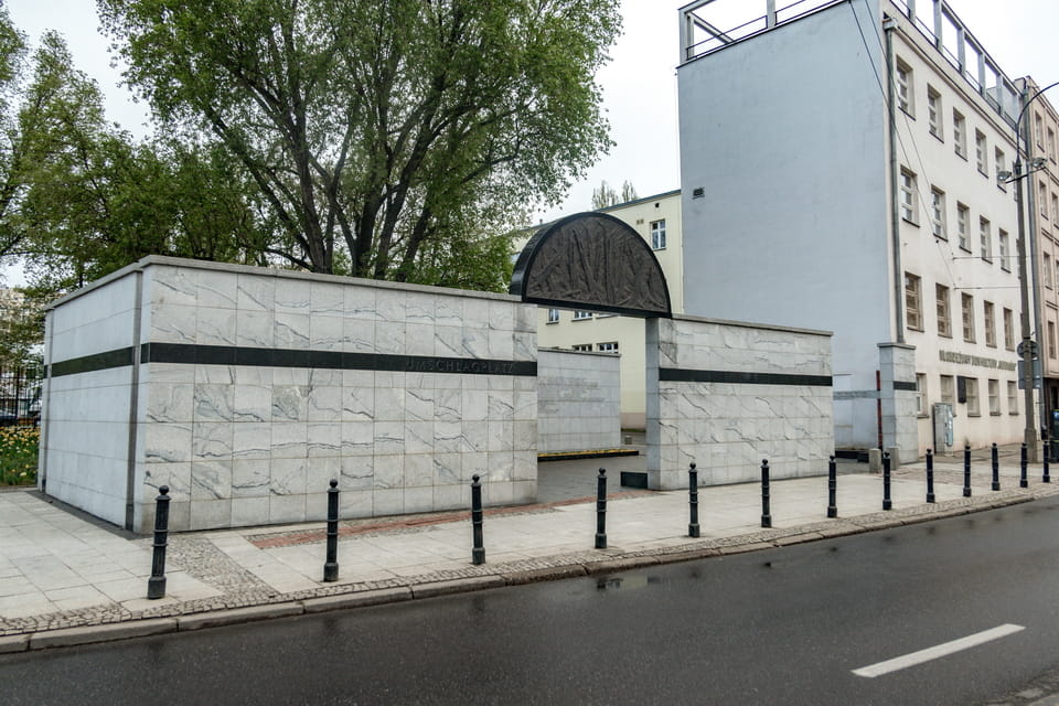
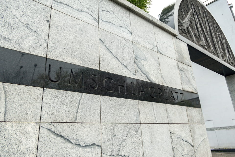
In those two months alone, approximately 265,000–300,000 people were loaded onto cattle wagons at the Umschlagplatz and transported to the Treblinka extermination camp, 80 kilometres northeast of Warsaw. Including the subsequent deportations of January and April–May 1943, the total number of people who passed through the Umschlagplatz en route to their deaths is estimated at approximately 310,000 — roughly three-quarters of the entire pre-war Jewish population of Warsaw. Today, the site is marked by the Umschlagplatz Monument, unveiled in 1988 at the corner of Stawki and Andersa Streets in Warsaw.
This article traces the history of each building on Stawki Street that formed the Umschlagplatz deportation area — before the war, during the deportations, and today — using archival photographs, maps, and contemporary comparative images. A practical visitor guide to the Umschlagplatz Monument and the surrounding historical sites is included at the end.
For a small number of people, the road from the ghetto led somewhere other than this square. A few kilometres away, across the Vistula, Jan and Antonina Żabiński were hiding around three hundred Jews in the empty animal enclosures and the villa of the Warsaw Zoo.
PLAC BRONI SQUARE: The Pre-War History of the Umschlagplatz Site (XVI century–1939)
The site today known as the Umschlagplatz is referred to in Polish as Plac Przeładunkowy (literally «transhipment square») or simply Umschlagplatz Warszawa by Polish-language sources. In German wartime documentation, it appears as Umschlagplatz Warschau. The same site and its history are referred to in Italian as Umschlagplatz Varsavia, in French as Umschlagplatz de Varsovie, and in Spanish as Umschlagplatz Varsovia. Common misspellings in English include «Umshlagplatz» (omitting the «c») and «Umschlagsplatz» (adding an extra «s»). This article uses the standard German spelling throughout. The square did not stand alone. A short walk to the south, inside the ghetto boundary, stood Pawiak — the German security police prison that became the deadliest place of detention in occupied Poland.
The pioneer settlers had attempted to cross the Stawki and Dzika streets as far back as the 16th century. It will take another two hundred years to pass before the date when the swamp-like area in the northern part of Warsaw will witness the erection of the earliest residential structures. As early as 1874, the newly made iteration of the city map of Warsaw was geographically accompanied by a new Stawki Street, with ‘the ponds’ as the word-for-word meaning in Polish. The pint-sized pieces of water would be featured on the site as late as the 1890s. As far as the epilogue of the Napoleonic wars in Europe resulted in the actual loss of the independence of Poland in favor of the Russian Empire, the supervision over the so-called ‘Królestwo Polskie’ (Congress Poland) had been entrusted to Grand Duke Konstantin Pavlovich. Of all others, this very ruler, later the failed pretender to the regalia of Emperor and a man to be kicked out of power at the height of the ‘November Uprising’ in Poland, approved the build-up of open ground within the borderlands of Stawki, Dzika, and Pokorna streets in Warsaw as late as 1824.

The newly-made Plac Broni (The square of armament) was not merely the open ground for the military exercises of the Polish army, but also the largest square in Warsaw at the time, with 420 meters on each side. Relatedly, the open ground had been initially endowed with pure military appropriation. The square-cut area was fenced with a wooden enclosure and made inaccessible to the locals. Following on from the results of the 1830-1831 ‘November Uprising’ (also known as the ‘Russian-Polish war), the Polish parliament (Sejm) was abolished, as well as the Polish army. From a narrower perspective, the former military grounds to the north of the city center (Plac Broni) were delegated to the occupational forces with the preservation of the initial designation. At that moment in time, the area also included the army barracks, which had been erected as far back as 1829, a year before the uprising. It will take another two decades for the administration to maintain repair works within the ‘Plac Broni’. By the middle of the 19th century, the former military grounds were in use on a more and more infrequent basis by designation and more often as an area for storage.

Within the years of the last decade of the 19th century, the ‘Plac Broni’ was destined to be subjected to a new, meaningful makeover. The western part of the former open ground was designated for the erection of the storage facilities as well as the expansion of the railway line to the north, a transport derivation of the ‘Droga Żelazna Nadwiślańska’ (generally regarded in English as the ‘Vistula River Railroad’). The ‘Plac Broni’ was also destined to witness another transformation within its southwest part. As early as 1895, the crossroad of the Stawki and Dzika streets (next to the modern UMSCHLAGPLATZ monument) was built with a wooden home shelter for the homeless, an erection that would outlast the years until the Second World War.
The new home shelter and the renovated storage and railway facilities were not the only means of the transformation of the area at the threshold of the XX century. Based on the decree, which had previously approved the elimination and moving of the local market on Walowa Street nearby, the southern part of the former military grounds was assigned to give space for a new merchant area to come. As early as 1901, a large wooden pavilion with two erections of the same assignment was built next to the home shelter. The relatively reasonable rental charges generated a demand for these new market facilities to the extent that up to 80% of the merchant area was soon leased. Along with that, the nearby area along Stawki Street was also leased on a subsidy basis, thus expanding the merchant facilities. At the time, the Jewish population prevailed among the residents of the district.

The interwar years, initially celebrated with the acquisition of Independence by Poland (based on the dramatic results of the Great War), witnessed a new wave of reconstruction for the area along Stawki Street. As late as 1921, ‘Dom Składowy Miejskich Zakładów Zaopatrywania Warszawy’ (Warsaw Municipal Supply Center) occupied some premises of the old market at Stawki 4/6. Virtually, it was the local administrative body, established with the sanction of the Warsaw City Council, to coordinate and maintain the modernization of the supply and merchant procedures. The new administrative formation agreed upon the reconstruction and expansion of an old railway affiliation, which had been carved into the military facilities back in the 1890s. The renovation of the freight terminal, in actual terms, the affiliate of the WARSAW GDAŃSKA station to the east, will take another decade to be performed within the major part of the former ‘Plac Broni’ site. During this period, new railroad tracks, as well as five large warehouses, were built.
1935 / 2020 COMPARISON:

 SLIDE me
On the date of putting into service, the new freight depot happened to become the largest of its kind in Poland with a carrying capacity of 170 000 tonnes of goods transhipped annually. In the pre-WW2 years, the freight terminal was increasingly used as ‘Plac Przeładunkowy’ or ‘transshipment site’ in English or later ‘Umschlagplatz’ in German, the sadly known euphemism for mass deportations from the Warsaw ghetto to come. Looking further forward, the remaining part of the former transport depot would be used by the Germans to maintain the mass deportations in 1942. The greater part of the freight terminal continued to receive and store the goods. In 1944, at the height of the ‘Warsaw Uprising’, the fighters of the ‘Home Army’ stormed into the station and took some supplies, still stored within the spacious warehouses. The railroad tracks were demolished within the post-war years, and the warehouses of the former freight depot (the eastern part of the former ‘Plac Broni’ had been preserved until the 1970s when the area was cleared to give space to a new residential district, present up today. Some remains of the former transport facilities (the eastern part, beyond the territory of the Umschlagplatz ‘transshipment area’) survived until the 2000s before the final demolition.


One more and never-fulfilled construction plan for the remaining area of the former ‘Plac Broni’ included the build-up of a new bus terminal with the first day of work scheduled for September 1, 1939. History had other plans, and the bus depot, drafted on paper with the spacious waiting room, a lunchroom, a multi-window ticket office, and even a washroom, was never to be fulfilled. The project implied a budget of no less than 150,000 PLN at that time. A new transport terminal was assigned to have a passenger platform of 120 meters long with the capacity to manage up to 12 buses at once, thus being the largest transport depot of this kind in Warsaw. The outbreak of the Second World War, the German air bombardments, the seizure of Warsaw, and later the occupation drew the line with the ambitious plans for the further transformation of the area of the former ‘Plac Broni’. The place for a never-built transport terminal was to be turned into the site of mass exodus during the Holocaust. The bureaucratic side of what happened on this square — the timetables, the requisitioned rolling stock, the paperwork that moved a quarter of a million people to Treblinka in eight weeks — is the subject of Raul Hilberg’s The Destruction of the European Jews, still the standard work on how the killing was organised.


Though the freight terminal to the north of Stawki Street would become a site of the forced exodus and the tragedy of the Warsaw ghetto, the maternal ‘Warsaw Gdanska’ station was left by the Germans to maintain its operation with the intended purpose of a transport terminal. Distanced 800 meters to the northeast of the Umschlagplatz memorial, the station, historically regarded as the ‘Vistula station’, was opened as far as 1877 as a transport point for a new ‘Droga Żelazna Nadwiślańska’ (Vistula River Road). It took almost two decades before the 1930s, and since the station had been burned during the First World War, to maintain repair works. In the years of the occupation, the Germans renamed the station ‘Warsaw Danziger Bahnhof’ with the preserved functions of one of the intermediary stations of the railroad system. The pre-war terminal was later demolished, and the year 1958 witnessed the opening of a new transport station with the generally known ‘Warsaw Gdanska’ notion.
1945 / 2020 COMPARISON
 SLIDE me
STAWKI 4/6 (NOW STAWKI 10): Schools, the Umschlagplatz, and the Wall — Then and Now
By the early XX century, Stawki Street in Warsaw was already notable for the multiformity of its housing development. Since the year 1895, the crossroad with Dzika Street had been occupied by the wooden shelter for the homeless, as well as new spacious merchant pavilions accompanying the area five years later. The district was not kept away from the construction of educational institutions as well. As far back as 1902, the purchased ground at Stawki 34/36 was developed (at the request of the Association of Mutual Assistance to Trade Workers of the Mosaic Confession) with a new Craft School, built for the comfort of 250 students simultaneously. As history went to the 1920s, three one-story schools (№ 120, 122, and 175) were built on a plot of ground at Stawki 21/23/25, respectively. At that moment, the part of the old market on the opposite side of the road had already been granted to ‘Dom Składowy Miejskich Zakładów Zaopatrywania Warszawy’ (Warsaw Municipal Supply Center), an administrative body initiated in 1921.
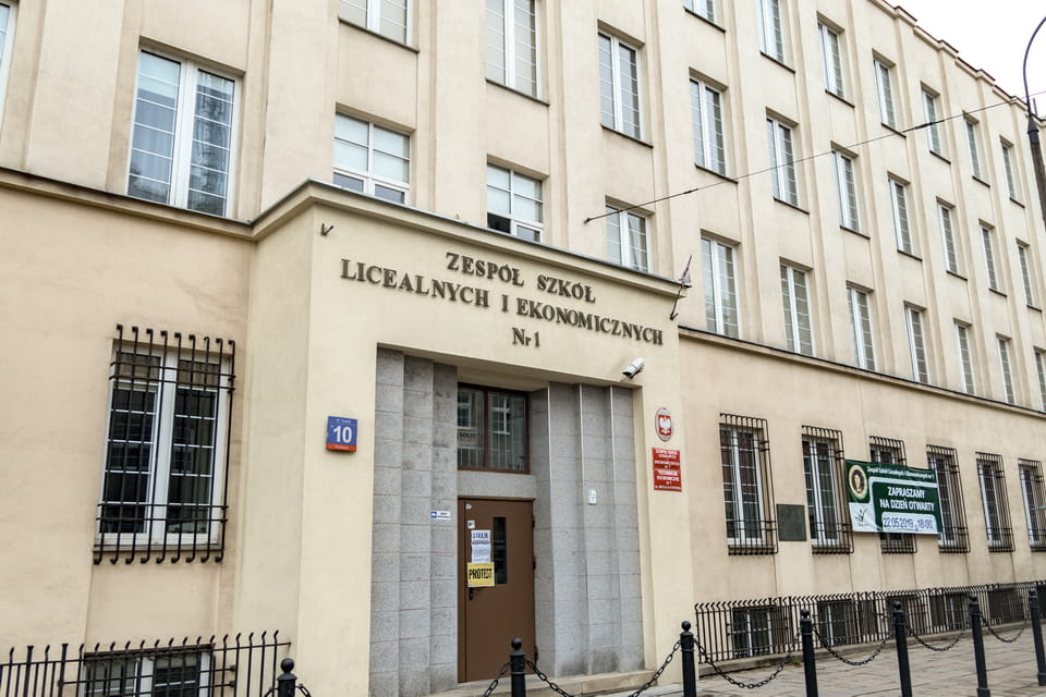
As far back as the 1930s, at the time of the epilogue of the reconstruction of an old freight depot to the north of Stawki Street, the local authorities built up some new erections, including a hard-wall building at Stawki 4/6. This new structure was assigned to perform the final steps in the makeover of the former merchant area. The building-up of a new monumental four-story erection was finally completed as early as 1935. Aside from a new office for the former ‘Warsaw Municipal Supply Center’, some premises were assigned to store the municipal archive. These prescriptions were no more than a drop in an ocean as the better part of the building was prescribed to host three schools at once: № 112, 120, and 122. Consequently, schools № 120 and 122, which had been previously operated on the opposite side of Stawki Street since the 1920s, were now granted new accommodation.


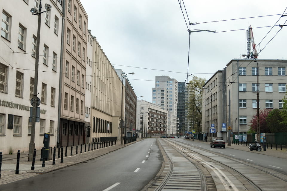


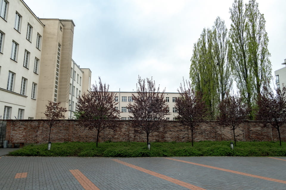
The majority of the sadly remembered photos of the Umschlagplatz deportation area during the occupation of the city and the mass expulsion of the residents of the Warsaw ghetto in the summer of 1942, depicted the open area just in front of the Stawki 4/6 building (generally far left). The area behind the building (in fact, the inner courtyard of the neighboring school at Stawki 8) was used by the Germans as a detention area, the waiting point for the doomed people, such as Janusz Korchak and his orphans, on their way to the Treblinka extermination camp. Today, one can observe the wall of red brick Apr. 70 meters long and 2 meters high. In factual contrast with the general assumptions and assertions of some guides that the wall is no less than an authentically preserved relic of the former Umschlagplatz ‘transshipment area’ since 1942, the well-known aerial photo of the area, taken in 1945, as well as the attestation of the recognized Polish historians, lends poor authenticity to that version. In defiance of its look and the metal particles on the top of the wall, it was built after the war, likely out of the remains of one of the pre-war erections. As late as 2014, part of the wall was demolished to be later reconstructed. Since 1958, the building has been home to Zespół Szkół Licealnych I Ekonomicznych nr 1 Im. Mikołaja Kopernika (Complex No. 1 of the High School and Economics named after Nicolaus Copernicus). In 2002, another Warsaw location was used to depict the Umschlagplatz site in the acclaimed ‘Pianist’ movie by Roman Polanski.
STAWKI 21 (NOW STAWKI 5/7): Schools as the Umschlagplatz Boundary — Then and Now
The second building, which occupied the area as far back as the mid-1930s and is sadly remembered within the period of the mass deportations, is the municipal building, initially assigned the Stawki 21 address. Back in the 1920s, three one-story schools were built on a spot of land opposite the home shelter and the old market. The grand plan for the modernization of the area included new premises for these three educational institutions. As early as 1935, two of them, 120 and 122, were moved to a new building at Stawki 4/6 on the opposite side of the street. The second-in-a-row building was built before the year 1937 and occupied the greater part of the territory nearby. The remaining school №175 was later moved here, as well as another Warsaw school, №153. The remaining erections of the former old schools would be completely demolished before World War Two.


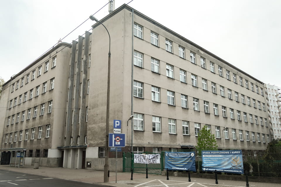
The building and two schools inside were destined to operate (for intended purposes) for a short period before the outbreak of the war. As the Germans occupied the city and later turned the area into the Umschlagplatz (transshipment site), the former educational building was also occupied by the SS soldiers as well as the members of the local ‘police of order’, generally formed of non-Polish citizens. One of the premises had also served as an office for the senior German officer, who would supervise the mass deportations nearby. The building at Stawki 21 (modern 5/7) was put into repair works years after the end of the war. As early as 1973, the Department of Psychology at the University of Warsaw moved into the premises of the renovated building. The modernization included the expansion of the wing to Andersa Street, which can be easily traced in the comparison of the photos. The repair works in the 1970s also revealed the scribbled inscriptions on the walls in the basement, the former detention premises for some inmates. The modern front side of the building, with a new address, includes a memorial plaque with a brief piece of information on the dramatic history of the building during the Holocaust.


STAWKI 8 (NOW STAWKI 10): The School Planned for September 1, 1939 — Never Opened
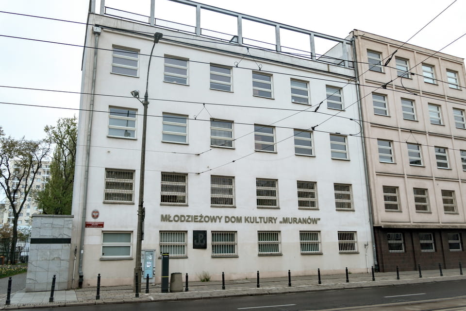
Towards the end of the 1930s, two built buildings (Stawki 4/6 and Stawki 21) at Stawki Street in Warsaw already accommodated five public schools (112, 120, 122, 153, 175), three of which (120, 122, 175) had been previously located on the crossroad with Dzika Street nearby. As late as 1939, the remaining storage facilities of the ‘Warsaw Municipal Supply Center’ were assigned for demolition to leave space for the erection of another educational building, another public school, scheduled to be open on September 1, 1939. The administrative and teaching staff were already complemented, as well as the list of pupils filled, and the educational schedule written. The outbreak of the armed aggression of the Third Reich cast a doomed shadow over the plans for a new school at Stawki Street, and the further occupation and the liquidation of the Warsaw ghetto metamorphosed the area and the intended purpose of the building endlessly. Still, as of the date 1939, the new erection, facing Stawki Street, was neighboring Stawki 4/6 with three schools and administrative premises and with an old shelter for the homeless on the corner of Dzika Street (it is unknown in what year it had been closed).


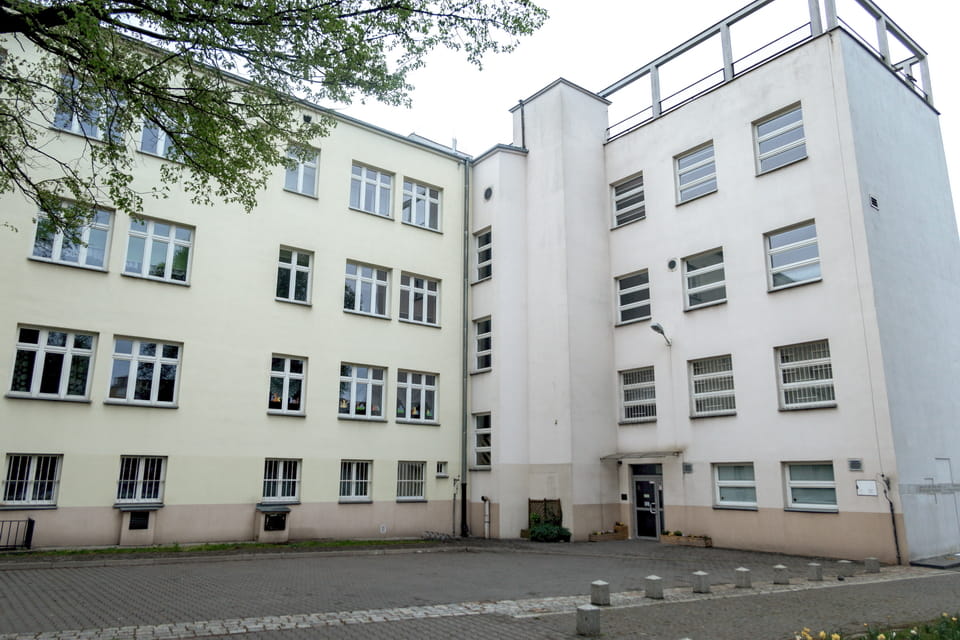
Summarizing the above, by the outbreak of the Second World War, the image of Stawki Street had already been transformed, not least due to a new building at Stawki 8, still with the smell of whitewash. With the occupation to come, the German presence, and later with the bleeding over the area into a site for mass deportation of the residents of the Warsaw ghetto, the designation of the never-opened school had been metamorphosed as well. The Germans disposed of a minuscule hospital within one of the premises of the buildings. Along with that, the building at Stawki 8 has been recorded in history due to more dramatic occasions, apart from the very location next to the deportation area of Umschlagplatz Warsaw. Those desolated residents of the Warsaw ghetto, who were herded into the ‘detention area’ and were not put into cattle trucks the same day for one reason or another, were now engaged to spend day and night within the so-called ‘containment area’. When nightfall came, these people were taken from Stawki Street (the sad panorama from photos) into the inner courtyard of the planned school. This very courtyard next to the wing of Stawki 8 and behind Stawki 4/6 is topographically regarded by both buildings.

Apart from the disposal of people within the courtyard behind two educational buildings, Germans found themselves in a more controlled position to supervise the inmates inside the building. In a wider dramatic sense, the doomed residents of the ghetto, who had been prisoners for almost three years in inhuman conditions, were now taken to spend day and night under the guards before being taken to the Treblinka death camp for extermination. Access to the toilets inside the buildings was forbidden, there were no active water pipes, and the herded people generally had no or a poor amount of provisions (as depicted in the ‘Pianist’ movie by Roman Polanski). Depending on the density of people crowded within cramped rooms, some of them had to stand all night without answering the call of nature. Consequently, the conditions were not too different from those in the cattle wagons, a means to take the victims of the ‘final solution’ to death camps. Years after the war, the inscriptions were found on the walls of the building at Stawki 8, once made by people on their way to Treblinka.


Even two years after the mass deportations of the summer of 1942, Germans used to detain some captives within the buildings of the former ‘transshipment area’ (UMSCHLAGPLATZ). On August 1, 1944, a unit of the Polish members of the Home Army, led by Stanisław Janusz Sosabowski, attacked the Germans within the territory of the former ‘Umschlagplatz’. At the same time, they managed to take the supplies within the former freight depot, the rebels succeeded in storming Stawki 8 buildings with the release of 50 inmates, who turned out to be Jews from Hungary and Greece. It took decades for this building to be repaired after the war. The photo of 1964 depicted new windows, yet the general outwall was still very similar to the state, which was liberated back in 1945. The building accommodates “Muranów” Youth Culture Center (Młodzieżowy Dom Kultury “Muranów” im. C.K. Norwida), which moved here as early as 2009 after years of reconstruction works.
THE FORMER HOMELESS SHELTER: A Pre-War Building at the Edge of the Deportation Area
In the late 19th century, despite the transformation of the former ‘Plac Broni’ area and the railway offshoot, the territory to the north of Stawki Street was mainly a wasteland and bare place. As recently as two decades before the end of the century, dozens of small ponds could still be recognized within the area to the west. As late as 1895, a new wooden building was erected on the crossroad of Stawki and Dzika Street with the intended purpose of becoming ‘DOM NOCLEGOWY DLA BEZDOMNYCH’, a shelter for the homeless. The property was run by the ‘Albertine Brothers’, a Catholic congregation that had been initiated in the Polish city of Krakow back in 1888. The institution was also granted partial financing on behalf of the local authorities and the city budget of Warsaw. At the time, Dzika Street had much more space within the city map of Warsaw, and a home shelter was located at Dzika 64.

At the outset of the ‘Great War’ (First World War), the mission of the shelter was shifted to become a refuge for escapees from the Russian Empire. The inter-war years of now independent Poland and painfully poor standards of life once again affected the wooden one-story building at Dzika Street. The building was slightly renovated and reopened in 1924 with a new address of Dzika 4, with the initial mission as a shelter for the homeless. At that moment in history, the institution had already gained a vicious reputation with the dialect designation as ‘the circus’. There were rumors that such a title came into general use due to a local police inspector, who was depressed with the poor conditions of the shelter and with its population, and proclaimed that the place was more like a circus or a ‘wild beast show’. In a factual sense, his exaggeration was close to the truth.

In the inter-war years, the shelter at Dzika 4, as well as the other institutions of this kind in Warsaw, were generally overpopulated with those who strived to find a place to live with a free plate of soup. This social prelude indeed resulted in poor sanitary conditions and even epidemics among the residents. On the other hand, the population included criminal elements, marginal figures, troublemakers, and the periodic alcoholic debauches that led to police bust-ups. In local use, the phrase ‘circus man’ was now to be associated with characterized marginal elements, drunks, and criminals, in contrast with any efforts of the administration to maintain a sort of ‘selection’ of the residents.

It is still historically unidentified: the exact moment in history when the old shelter was closed, and the wooden erection was demolished. The building could be easily observed within the aerial photos taken in 1935, yet during the occupation and the deportations, another construction was at the place. Taking into factual consideration the staged ‘refinement’ of the area in the 1930s: the liquidation of an old market, the build-up of three new municipal buildings for schools, and the upcoming plans of transformation of the remaining open area into a large bus depot, it’s likely that the shelter had been out of usage before the Second World War. While drawing comparisons with the modern outlook of the former ‘Umschlagplatz’ area, the wooden home shelter was once located on the very crossroad of Stawki and Dzika streets, Apr. 50 meters to the left of the memorial.

THE UMSCHLAGPLATZ MONUMENT TODAY: Location, How to Visit, and Nearby Sites
Location: The Umschlagplatz Monument stands at the corner of ulica Stawki and ulica Andersa, in the Muranów district of Warsaw — the former area of the Warsaw Ghetto. The monument is located next to the building at Stawki 5/7 (the former school at Stawki 21, now the University of Warsaw’s Department of Psychology). GPS: 52°15’08.1″N 20°59’20.7″E
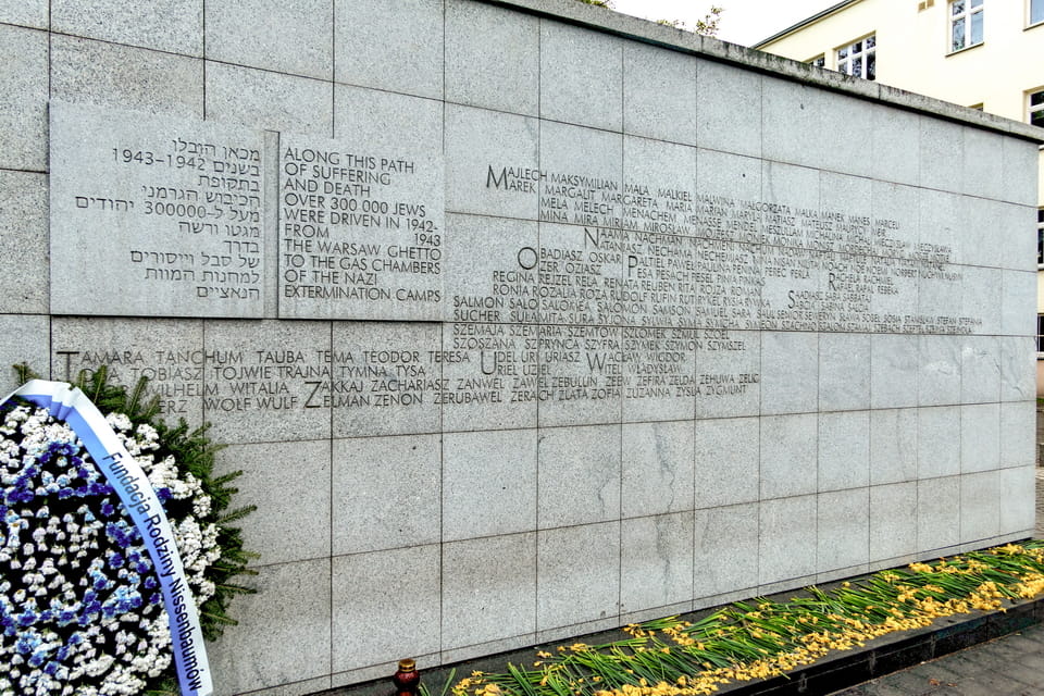
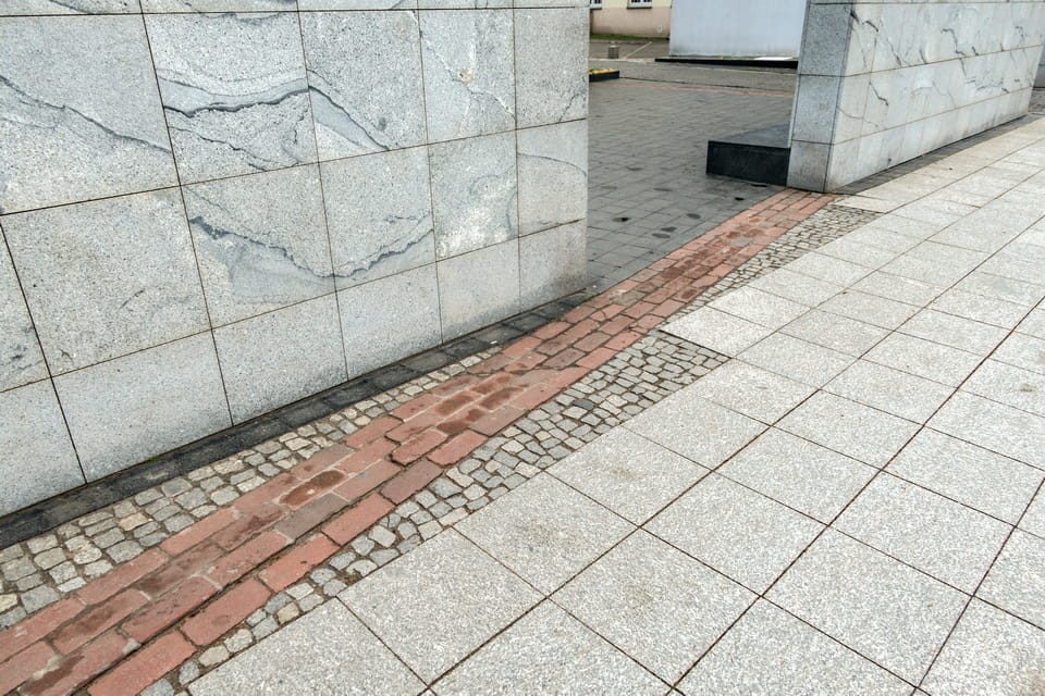
The Umschlagplatz monument: Designed by architects Hanna Szmalenberg and Władysław Klamerus, the Umschlagplatz Monument consists of a white marble wall approximately 32 metres long, with a symbolic opening representing a cattle wagon door. The inner surface of the wall bears 4,421 Jewish first names — names most commonly given to Warsaw’s Jewish community before the war, each representing the thousands who were deported. The monument was unveiled on 18 April 1988, the day before the 45th anniversary of the Warsaw Ghetto Uprising. Admission is free; the site is open 24 hours. The brick wall behind Stawki 10 (built after the war from wartime rubble) marks the approximate eastern boundary of the former deportation area.
Getting there:
- On foot from the POLIN Museum: approximately 700 metres northwest. Walk north along Jana Pawła II Avenue, then turn left onto Stawki Street.
- By tram: Lines 15, 17, 22 stop at Anielewicza Street (stop: «Centrum Handlowe Arkadia» or «Dzika»), a 5-minute walk.
- By bus: Lines 106, 157, 180 stop at «Okopowa/Dzika» or «Stawki», a 3-minute walk.
- By metro: Line M1 to Ratusz-Arsenał, then a 20-minute walk northwest, or tram from Plac Bankowy.
Nearby historical sites — combining with a Umschlagplatz visit:
- Warsaw Ghetto Heroes Monument (Pomnik Bohaterów Getta): ~500 m southeast of the Umschlagplatz Monument. The main Warsaw Ghetto memorial, depicting the uprising of April 1943. Free, open 24/7.
- POLIN Museum of the History of Polish Jews: ~700 m southeast. One of Europe’s leading Jewish history museums, housed in a striking modern building next to the Ghetto Heroes Monument. Tuesday–Sunday 10:00–18:00 (Thursday until 20:00). Admission: approx. 35 PLN adults (approx. €8). Closed Mondays and major Jewish holidays.
- Warsaw Ghetto Wall Remnant (ulica Sienna 55): ~2.5 km south. The only preserved section of the original Warsaw Ghetto wall is at the corner of Sienna and Złota Streets. Free, accessible 24/7.
- Warsaw Gdańska Railway Station (Dworzec Gdański): ~800 m northeast of the Umschlagplatz Monument. The «Vistula Station» mentioned in this article is the parent station of the Umschlagplatz freight terminal. Still operating as a passenger terminal today.
One of those pulled out of the crowd here survived to describe it. Władysław Szpilman was standing on this square with his parents, his brother, and his two sisters in August 1942 when a Jewish policeman who recognised him dragged him out of the column; the rest of the family boarded the train to Treblinka.