

Omaha Beach today: D-Day 1944 then and now
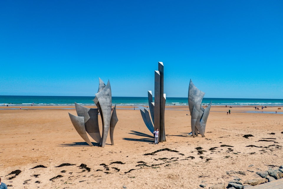
The stretch of sand and dune grass between Vierville-sur-Mer and Colleville-sur-Mer in Normandy does not announce itself dramatically. It is a beach — Omaha Beach today — that looks like much of the Norman coast: open, windswept, sometimes beautiful. The Les Braves memorial stands in front of the museum car park. A few German bunkers remain on the bluffs above, preserved and weathered.
This article documents Omaha Beach then and now: what the beach, the bunkers, the villages of Saint-Laurent-sur-Mer and Vierville, and the Normandy cliffs looked like in 1944 — and what they look like on the ground today. More than 50 archive photographs from American, British, and German sources are set alongside my own photographs taken during a visit to Normandy in 2019. Each section moves through the historical story and the physical landscape simultaneously, from the early British commando raids of 1942 through the D-Day landings of June 6, 1944, and into the post-war memorialisation that has shaped the site you can visit now.
Practical visitor information — including the Omaha Beach Memorial Museum, the Normandy American Cemetery, the preserved German bunkers, and how to get to the site from Bayeux or Paris — is provided at the end of this article.

THE NORMANDY COAST BEFORE D-DAY: From Viking Raids to Atlantic Wall
Thanks to the thousands of historical and fictional books, movies like ‘The Longest Day’ (1962), ‘The Big Red One’ (1980), ‘Saving Private Ryan’ (1998), the TV series ‘Band of Brothers’, and video games, the sandy coast of Normandy in France, has become one of the most recognized images of the Second World War. On the ground, the scale of the battles here held no comparison to the largest clashes on the Eastern Front between Hitler’s Germany and Stalin’s USSR. Still, in the public conscience, the Allied landings in Northern France have been regarded as one of the climaxes of the largest conflict in world history. As a historical region, Normandy saw its wars begin in 56 B.C., when the Roman legions conquered the region under the command of Julius Caesar. Three centuries later, the local population suffered from the sea raids of the Saxons and Franks from the territory of modern northern Germany, and Frisians from the coastal regions of modern Netherlands, Denmark, Germany, and Belgium.
Those ancient local invasions were chaotic, but the deteriorating situation prompted the Roman Empire to establish a centralized coastal defense system known as the ‘Saxon shore’. Built mainly at the end of the 3rd century, the defensive line consisted of fortified outposts. The territory of modern Normandy was included in one of the three imperial commanding armies in the area – ‘command dux tractus armoricani et nervicani’. It is worth noting that apart from the local population who were called to arms under Roman command, the representatives of German tribes were also among the troops stationed in the region. In a wider sense, the naturalized Saxons, Franks, and Frisians, new citizens of the Roman Empire, were sent to the coast to withstand the raids against their yesterday’s countrymen. Among the well-known legions stationed in Normandy then was a notable ‘Prima Flavia Gallicana Constantia’, who served as a border army until the end of the 5th century. The well-known Cotentin Peninsula owed its name to the city of Coutances, which was once called Constantia.
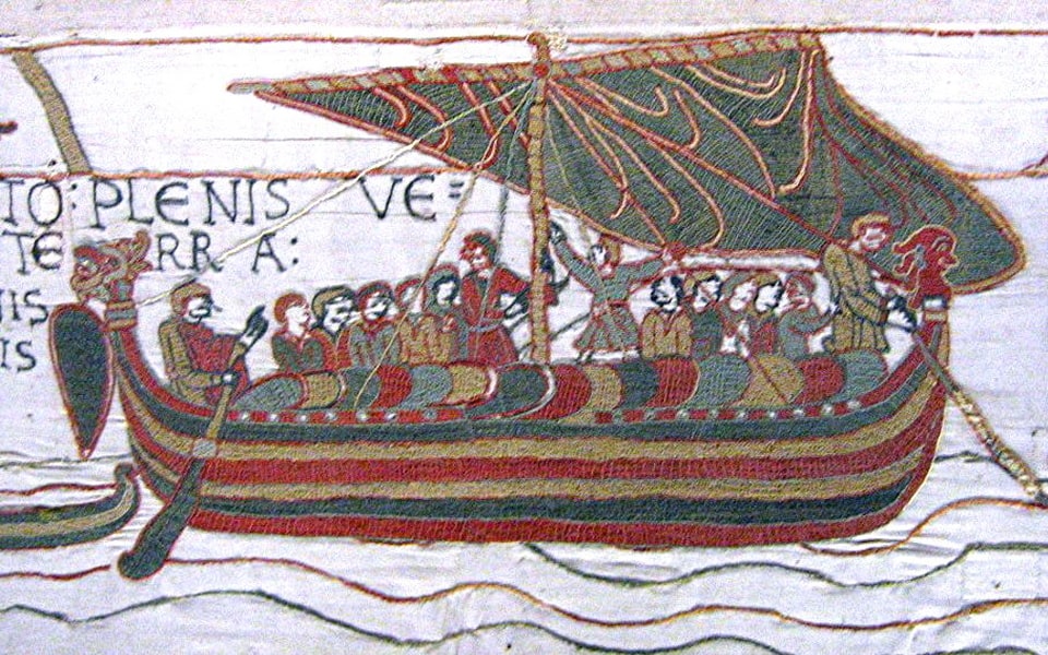
This later period of Roman rule brought foreign soldiers, combat outposts, and the region’s rapid Christianization. After the fall of the Roman Empire, the territory of north-west France fell under the Franks, who, with time, assimilated other ethnic groups, including Saxons, who had lived in the area they called ‘Otlinga saxonia’. Several centuries of relative calm ended at the end of the 8th century when the coastal areas suffered the invasion of northern conquerors, whom the locals called Normanni or Nortmanni, which meant ‘people from the North’. The raids were usually conducted in the summer, aiming primarily at undefended Christian monasteries, and with the coming of winter, the Normans came back to Scandinavian lands. In 845, they penetrated the continent to the extent of seizing and looting Paris. In 911, Frank King Charles the Simple (879-929) signed a peace deal with a Viking warlord, Rollo (860-932), making him the first ruler of Normandy, the newly established name of the previously called Neustria region. In the XI century, Rollo’s descendant William the Conqueror expanded the lands under family rule. It was from Normandy that the famous ruler launched his invasion of England.
In 1203-1204, Normandy, which suffered from internal wars for power after the death of William the Conqueror, was taken by the French King Philip II (1165-1223) and lost its status. Normandy quickly became accustomed to French rule and became a completely French province. It became one of the main battlegrounds between France and England during the Hundred Years’ War (1337-1453). After returning to French rule, Normandy preserved some of its special rights until the French Revolution in 1789. The people of Normandy were not among the zealous supporters of Napoleon Bonaparte but were pragmatic and politically cautious. In 1870, when the French army retreated during the Franco-Prussian War, the enemy forces occupied the area. They established a severe occupational regime with expropriations, which made the locals hate the Germans for decades. While Normandy saw no enemy boots on her soil during the First World War, its citizens fought bravely on other fronts against the Germans in the Second World War for half a century. The German occupation in the summer of 1940 brought painful experience to the people of Normandy, and a dream of liberation and freedom became a part of everyday life until the tide of the war shifted.

OPERATIONS CURLEW AND AQUATINT (1942): British Commando Raids on the Omaha Beach Coast
While most WWII enthusiasts know the story of the failed Allied operation near the port of Dieppe in Northern France in August 1942, the lesser-known British missions somehow worked up to the 1944 Overlord. In November 1941, a small unit from the famous British Wiltshire Regiment got an assignment to plan and conduct a raid against the German coastal defense in France. The operation had several objectives beyond the tactical level of penetration. First, to probe the enemy’s defense in Northern West France and gain intelligence information for the possible future opening of the so-called Second Front. In a more narrow sense, the daring raid should have given the British commandos a unique experience on the ground. The whole mission was codenamed Operation Curlew after a naval cruiser ship of the same name, which was sunk by the German Junkers 88 bombers near Narvik during the Norwegian campaign on May 26, 1940, with a death toll of nine British sailors.
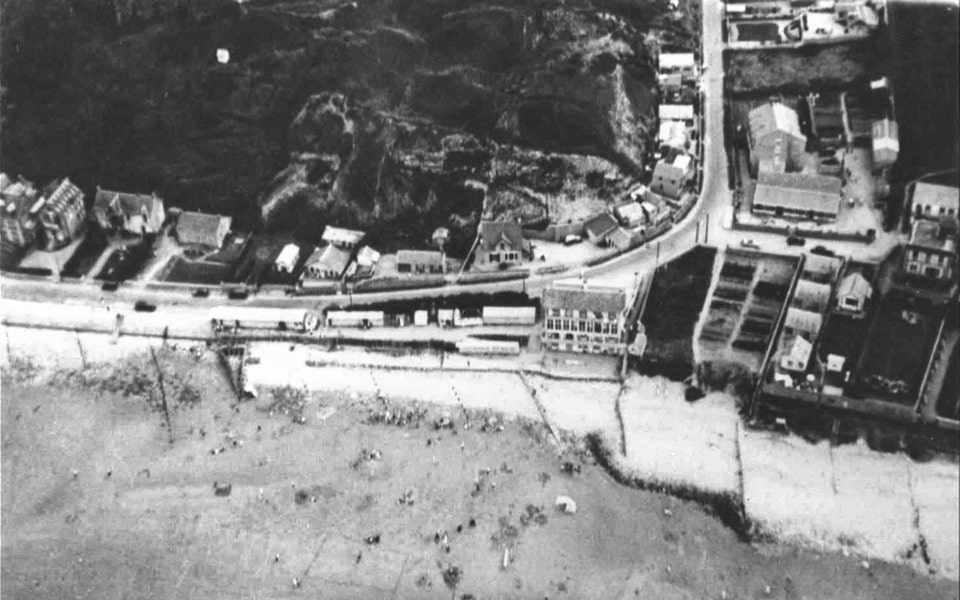

The unique fact about Operation Curlew, which its participants could not grasp at the time, was the location that was chosen for the raid: a coast in Normandy near a small town called Saint-sur-Mer. Back then, there was nothing special about this place, a coastal commune 17 kilometers from the larger city of Bayeux, with a town the size of a village with fewer than three hundred citizens living above the cliffs facing the English Channel. The night of 11/12 January 1942 was chosen as a mission date. Fifteen British commandos, four officers, and eleven soldiers took part in what was known as Operation Curlew. They were delivered to the French coast by two 11-meter Eureka boats, which would later become essential during the 1944 landings. Even considering the restricted resources and staff, the operation was the largest mission of such kind against the French coast at that point. The commandos got ashore, where they spent about an hour before departure. As they did not confront enemy forces, since the Normandy coast was poorly defended at the turn of 1942, the operation was considered a failure, though soldiers gained some experience, and the work of the navy was highly regarded. The Curlew participants lost three Tommy guns and one Lewis gun because the Eureka boats lacked landing ramps, and commandos had difficulties getting ashore with their assault gear.
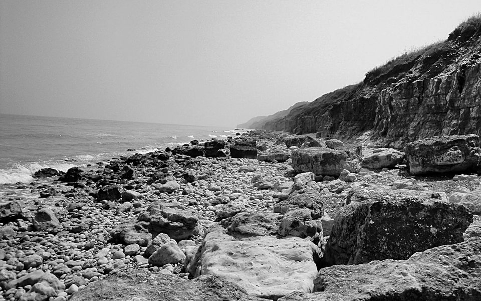
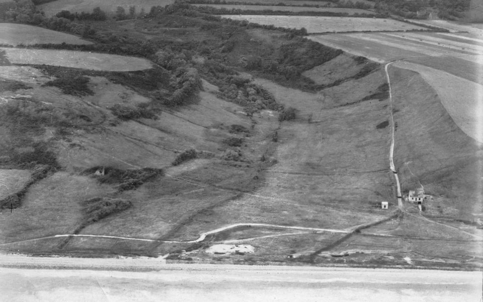
Seven months after the Operation Curlew raid and after several other even lesser-known missions, the failed landing in Dieppe became a catastrophe for the assault troops. Among six thousand men, mostly Canadian forces, in less than ten hours, 3,623 were killed by the Germans, wounded, or taken prisoner. The fiasco of Operation Jubilee in Dieppe, on the other hand, did not stop the British from conducting probing raids against the occupied French coast. The next operation, many times more moderate in scale, was planned for September 1942 and was codenamed ‘Aquatint’. In contrast to Curlew, this time the raid had a clear objective: to take a German prisoner back home across the Channel. The raid was scheduled on the night of 11/12 September, but because of the intense fog, it was launched the next evening. In the darkness, the team missed the launching site, a coastal commune called Sainte-Honorine-des-Pertes, and instead they set ashore near Saint Laurent-sur-Mer, about three kilometers west, and the site of the January Curlew mission.
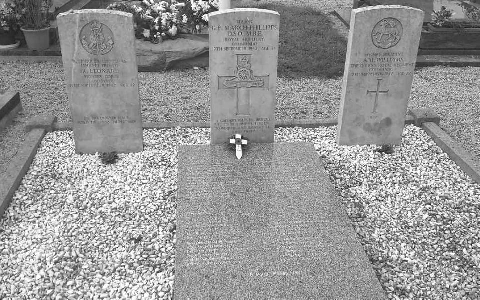
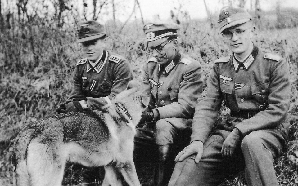
After leaving the larger boats, the assault crew used Goatley boats to set ashore beneath the cliffs. A team of ten men penetrated the shore, but soon they met the German patrol. The commandos took cover, but the enemy had a dog, which could reveal their position, and the raiders opened fire first, not knowing that the area was densely filled with enemy forces. The Germans opened fire from the machine guns and used grenades and a searchlight on the cliff against the raiding team. The latter managed to get into their Goatley boats, but several minutes later, a searchlight caught them from the dark, and a burst from a machine gun attacked them. The surviving men had no alternative but to get back to the shore controlled by the enemy. In the end, three men were killed: party leader Gus March-Phillips, Alan Williams, and Richard Leonard (his real name was Richard Lechniger; he was a Jew). Four men were taken prisoners on the shore immediately after the accident, and three more were captured later. Captain Graham Hayes swam further west along the shore, then was helped by the French resistance, but later betrayed and handed over to the Germans, who put him in prison, where he was executed in July 1943. In the end, none of the eleven men (one was left to guard boats, and then penetrated the shore) returned home to England to continue the fighting. A little Pisser boat, which delivered the team toward Normandy, got damaged by the German fire but successfully went back across the Channel.
THE ATLANTIC WALL AT OMAHA BEACH: German Bunkers and Defenses — Then and Now
After several British raids against the Nazi-occupied French coast in 1942, the so-called Führerbefehl 40 (Führer Directive number 40) issued by Adolf Hitler, prescribed the creation of a massive defensive system along Western Europe, later known as ‘Atlantikwall’ (The Atlantic Wall). Of course, covered operations such as Curlew (which was not known to the Germans because the commandos did not confront the enemy) were not the primary cause of Hitler’s concern, but the idea to secure what he had already gained in the West since Barbarossa in the East had halted. It is also interesting to note that the previous Führer Directive 39 on December 8, 1941, put an end to the German offensive on the Eastern Front as a reaction to a massive Soviet counter-offensive. With the Atlantic Wall, pure military considerations regarding the coastal defense made space for Hitler’s architectural fantasies, which later dangerously postponed the creation of a defensive line against the Allied Second Front. Considering the scale of the clash with the Red Army in the East, Germany planned to defend the whole coast of Western Europe with limited forces, which would later predetermine the outcomes of Operation Overlord.
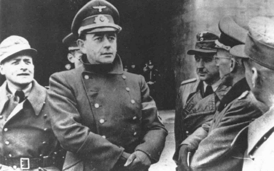
The span between Spain in the South and Norway in the North was to be protected by only 300,000 troops and 15,000 bunkers, of which only 12,000 were ready in June 1944. One year after the order to erect the Atlantikwall, its readiness was nowhere close to Hitler’s aspirations, and if the Allied invasion had happened in 1943, the fortifications would have been much easier to conquer. On November 3, 1943, Hitler issued Führerbefehl 51, prescribing fast preparation for a two-front war, meaning the fortification in France in the first instance, since the Allied troops had already landed in North Africa and Italy. The directive not only pressed the creation of physical obstacles, but increased the presence of Wehrmacht troops up to fifty-eight divisions, and the famous African hero Erwin Rommel was assigned Inspector-General of the Western Coast, and in the Spring of 1944 as the commander of Heeresgruppe ‘B’.
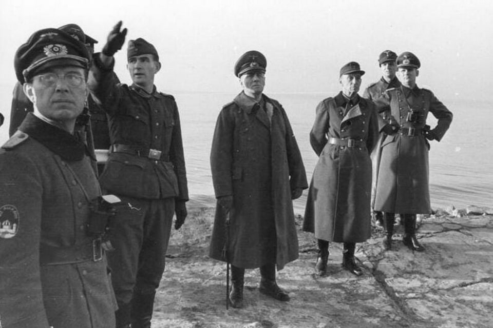
The German coastal defense system in Western Europe and in Normandy in particular, which the Allies finally chose for the invasion rather than Pas-de-Calais to the North, had its hierarchy. The smallest element was Widerstandsnest or simply WN (the resistance nest), which formed Stützpunkt or ‘Strongpoints’, therefore combined into Stützpunktgruppen or ‘strongpoint groups’. The two largest defense clusters were defense sectors (Verteidigungsbereiche) and Festungen (fortresses). All fortifications, even the smallest resistance nests, were reinforced concrete structures built to hold their sector for at least one week as self-sufficient strongholds. The Germans had around two hundred and fifty types of bunkers and reinforced structures. Apart from the obvious intended purpose, they served as observation points, warehouses and artillery depots, communication hubs, air defense strongholds, searchlight positions, headquarters, and personnel lodgings. The most common type of bunkers at the Atlantic Wall was known as ‘Tobruk-stand’ or simply ‘Tobruk’, named after the Libyan city of Tobruk, where they were built for the first time in 1941. This fortified box could hold round defense, had walls 40 cm thick, and required only eleven cubic meters of concrete for building up, compared to 600 with larger six-man bunkers. By June 1944, hundreds of these bunkers were placed on the coast of Normandy.
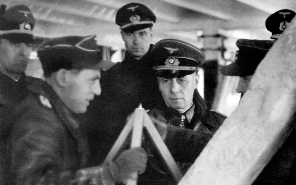
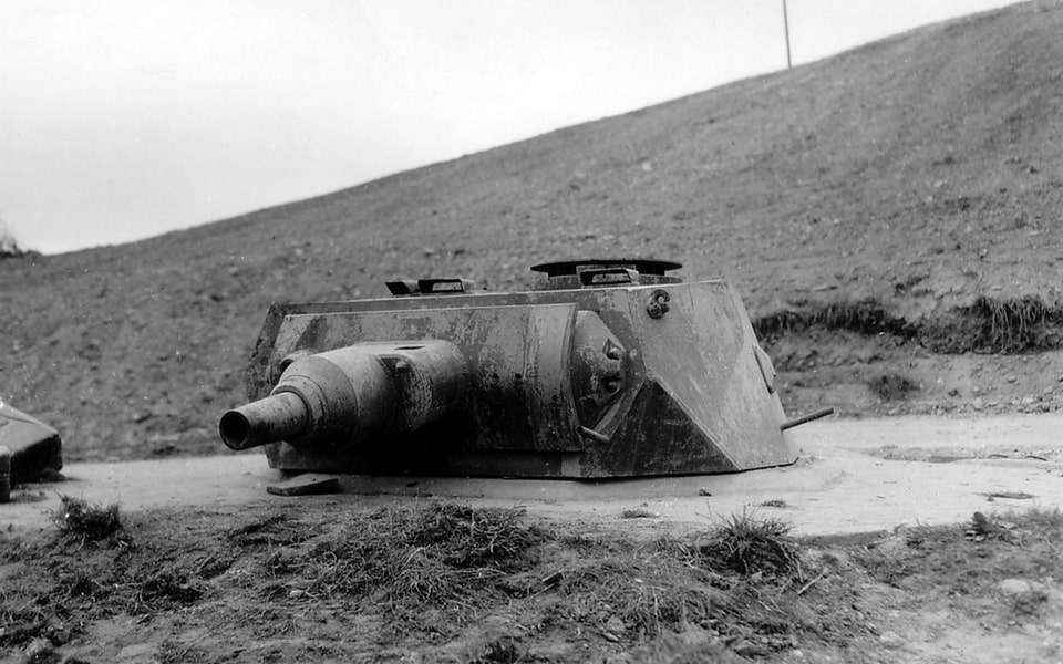
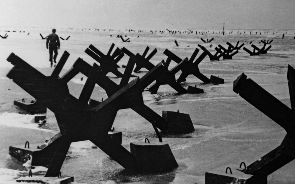
Overall, between 1942 and 1944, the Atlantikwall consumed 17.3 million cubic meters of concrete and 1.3 million tons of steel. The coastal defense on the French coast included 343 gun batteries with a total of 1,348 guns of different calibers. Not all of them were made in Germany since Hitler’s Atlantic Wall made use of trophy French, Czech, British, and even Russian guns. Apart from large caliber installations, many bunkers housed smaller calibers, usually taken from German or French tanks, or light mortars were used to increase the overall firepower. By the time of the Allied invasion in June 1944, the Germans under Rommel’s supervision had laid 6.5 million anti-tank and anti-personnel landmines. Along with that, half a million foreshore obstacles were put in several rows along the coastline to cover the area between the low and high tides, though Rommel wanted twice that amount. More than a million wooden stakes, two meters high with sharpened tops, were placed inland as obstacles against Allied parachute forces. Summing up, all these coastal obstacles and defensive lines looked very much like the infamous entanglements from the First World War on its Western Front.

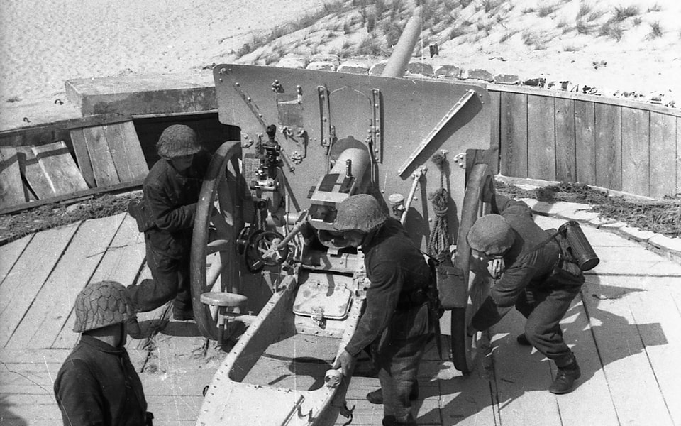
Several of the original German bunkers (Tobruk-stands and Widerstandsnest positions) that were part of the Omaha Beach defenses in 1944 remain standing on the cliffs and beach today. These are among the most photogenic and historically significant structures you will see when visiting Omaha Beach — and the photographs below show each key fortification as it appeared in June 1944 and as it looks now, after more than eighty years of erosion, commemoration, and time.
D-DAY AT OMAHA BEACH, JUNE 6, 1944: The Bloodiest Landing of the Normandy Invasion
THE AMERICAN FORCES. The first detailed version of the plan for the Allied landing in France was ready as early as May 1943, with May 1, 1944, as a target day. Three infantry and two airborne divisions, backed by another two divisions and two tank brigades in immediate reserve, were planned to land on a thirty-mile front in Normandy, divided into three target beach areas. Later on, the Allied command took a more ambitious agenda, and three landing areas were expanded to five: two American, three British, and Canadian. The latter three were initially named Gold, Jelly, and Sword, but thanks to Winston Churchill, Jelly was renamed Juno. Two American beaches were initially codenamed X-Ray and Yoke but were renamed Omaha and Utah, respectively, on March 3, 1944, just three months before D-Day. Omaha was the largest city in the US state of Nebraska, and Utah is a state. Despite the common belief that these toponyms reflected the biographies of the V and VII Corps commanders, Leonard T. Gerow (1888-1972) and J. Lawton Collins (1896-1987), none of them were from Nebraska or Utah.

According to the landing plans, two American beaches, Omaha and Utah, were assigned to the US V and VII Corps, respectively. While Utah became a battleground for the US 4th Division, the stretch of the French land designated as Omaha Beach was entrusted to the 1st and 29th Divisions. On June 6, 1944, the latter two would suffer ten times more casualties than the troops at Utah. A few soldiers who were assigned to land on Omaha knew that a month before Overlord, their sector was already considered the toughest of the five designated landing areas in Normandy. Back in January 1944, the sector was studied by the Combined Operations Beach Reconnaissance and Assault Pilotage Parties, or shortly COPP, including a secret assault of two officers on the shore. Their reconnaissance mission concluded that Omaha Beach was a bad choice for the invasion and would cause significant casualties. Unfortunately, the sector was the only possible landing area between the Utah sector to the West and three British beaches to the East.

The US 1st Division, better known as ‘Big Red One’, was a veteran unit hardened in the battles against the Germans in North Africa and later through Italy in this war, and fought their predecessors during the First World War. Their first clash with the renewed Wehrmacht occurred in Tunisia in early 1943, including the famous Battle of Kasserine Pass. After eliminating the remains of the Axis forces in Africa in May 1943, the 1st Division had only a brief rest before being involved in the Invasion of Sicily in July, where it experienced heavy fighting and casualties before finally being transferred back to England in November. The combat pass of the division was later depicted in the 1980 movie, ‘Big Red One’, with Lee Marvin and young Mark Hamill. While the men from the 1st were mostly hardened veterans, Normandy was destined to become the pioneer battleground for the 29th Infantry Division in the Second World War, though it was formed back in 1917 and spent twenty-one days in combat just before the end of the First World War, that time receiving a thirty percent casualty rate. The Division was reestablished in February 1941 but was not sent to England until October 1942. The unit was initially designated for the planned cross-channel invasion and did not gain relevant combat experience in North Africa or Italy.

According to the Overlord schedule, the landing on Omaha Beach was divided into two phases: the initial one included seizing control of the coast on the morning of D-Day, and the following arrival of much larger landing forces after the Beach was secured. The first wave of the assault force was codenamed ‘Force O’, and on paper, 34,142 men and 3,306 vehicles were planned to land on the Beach by noon of D-Day. The core of those vanguard units was the men from the 1st and 29th Divisions, as well as two battalions from the Provisional Ranger Group. The second wave, named ‘Force B’, comprised 25,117 men and 4,429 vehicles to land in the afternoon on the first day of the invasion. The third wave, comprised mostly of the men from the 2d Division, was assigned to bring another 17,500 men and 2,300 vehicles on D+1 and 2. The remaining units of the V Corps, 32,000 men and 9,446 vehicles, were meant to arrive in Normandy by D+15 days.
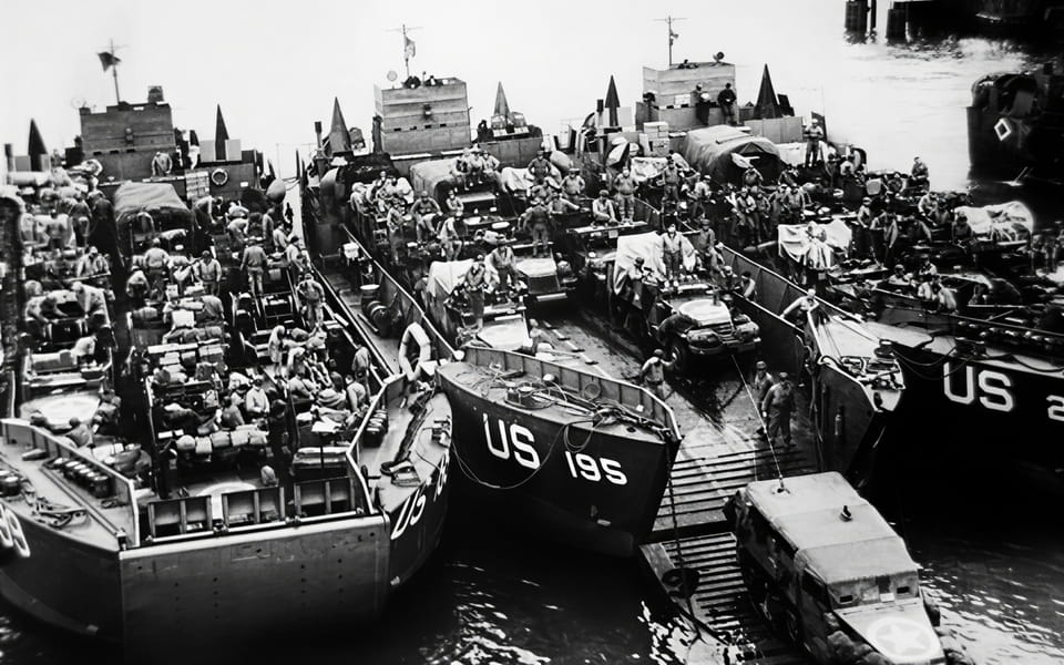
When speaking about the units of the 1st and 29th Divisions that were assigned in the first most important wave, it was two regiments: the 16th Infantry Regiment from the 1st Division and the 116th Infantry Regiment from the 29th Division. The men from these two army units were destined to face history as the conquerors of Omaha Beach. 16th Infantry Regiment bravely fought in the Tunisian campaign, then participated in the invasion of Sicily in July 1943, and awaited D-Day in France since October, being stationed in southwestern England. Colonel George A. Taylor (1899-1969) was a commanding officer in the regiment since April 1943, and James K. Woolnough (1910-1996) was his executive officer in the 16th. As a part of the 29th Division, the 116th Infantry Regiment spent twenty months in England in training and preparations for the invasion of France. Colonel Charles D.W. Canham (1901-1963) became a commanding officer in October 1942.
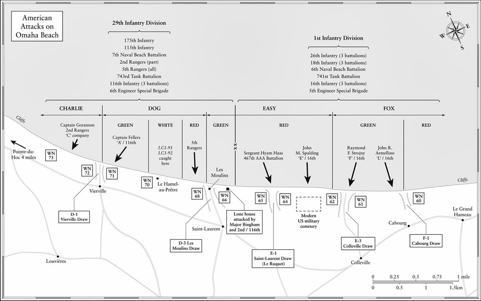
The Omaha Beach sector was not only divided between two Infantry regiments, the 16th (1st Division) and 116th (29th Division), but also divided into smaller landing zones. The 116th’s sector opposite the villages of Vierville and Saint-Laurent-sur-Mer was divided into two landing zones: Charlie and Dog, with the latter also subdivided into four areas: Dog Green, Dog White, Dog Red (Company E), and Easy Green. To the East, the zone of responsibility of the 16th Regiment, opposing Colleville, Cabourg, and Le Grand Hameau, included Easy Red (Company F), Fox Green, and Fox Red landing areas. In addition, two landing areas called Able and Baker to the West were also a part of the Omaha Beach sector. The initial objectives of the first wave on Omaha included not only getting ashore, but securing five draws, or valleys, or entrances. From West to east, they were codenamed D-1, D-3, E-1, E-3, and F-1. The first two were in the area designated for the 116th Regiment, and the remaining three aimed for the 16th. The officers and soldiers in the regiments had meticulously studied detailed maps and reconnaissance photos of the area, which included the location of every building or fortification. The landing units hoped to reach Route Nationale 13, the largest regional road running from Cherbourg to Caen through Carentan and Bayeux.


THE GERMAN 352nd INFANTRY DIVISION: Forces Defending Omaha Beach on D-Day
Had the Allied armada of the size of 1944 landed in Normandy and particularly in the Omaha sector a year before, in June 1943 or 1942, they wouldn’t have faced so much resistance. The beach lacked its obstacles and thousands of mines, with no fortified machine guns strongpoint above the cliffs. Toward June 1944, when the Allied armada finally touched the ground in France, the Germans had fifty-eight divisions and numerous smaller additional detachments, or around 800,000 men in France, Belgium, and the Netherlands. In contrast to the fully mechanized armies of the invasion, the Germans and their auxiliary units still possessed 115,00 horses in the west. Even though the eight hundred thousand figure looks impressive, only a part of them were considered potentially combat effective, and at least twenty-three divisions were the so-called Bodenständige (static position) divisions with low mobility, inferior to the so-called Kampfwert (combat effectiveness), and were regarded as suitable only for defensive actions. On the other hand, up to sixty percent of the officers stationed in France in 1944 were combat veterans of the Eastern Front, often with health limitations but also with impressive experience. Their logistics in Normandy were a mess because of the wide range of weapons and calibers they used, mostly captured French, Belgian, Polish, Czech, or russian arms. While the preparations for the Allied invasion lasted for months, it was in May 1944 that the Germans ordered the removal of civilians from the coastline in immediate proximity to the beaches. In addition, the local French government appealed to parents to evacuate all children from the stretch of coast between Grandcamp-Maisy and Quistreham. This resulted in the moving of tens of thousands of civilians further inland, thus clearing the Carentan-Caen area where 250,000 people had recently been populated.
One of the key German units destined to face the Allied invasion in Normandy was the 716th. Infantry Division, a ‘Bodenständigen’ or ‘static’ unit, was designated for a static non-mobile defense. It was formed back in May 1941 and spent its next three years specifically in France, being transferred to the Bayeux-Caen area in March 1942, where the unit replaced the 323rd. Infantry Division (was sent to the Eastern Front). Since May 1942, the 716 Division was assigned to the German 84th Corps of the 7th Army. Similar to other ‘static’ units in France, its personnel flow was of low quality, mostly from elderly Germans, recent members of home defense, Volksdeutsche, and volunteers among prisoners of war. By December 1943, when the division’s strength reached its peak of 9,343 men, up to forty percent of them were non-Germans, mostly Volksdeutsche from Silesia and Pomerania in Poland; some of them were veterans of the September 1939 campaign against the Germans, which added tension and suspicion among the German officers. When the manpower fell to 7,197 in early 1944 due to the cannibalization of the personnel in favor of the reinforcements sent to the East, the 716. Infantry Division was once again mixed with non-Germans, this time by three so-called ‘Ost-Bataillons’ (East battalions): 439, 441, and 642 recruited from the Soviet POWs.
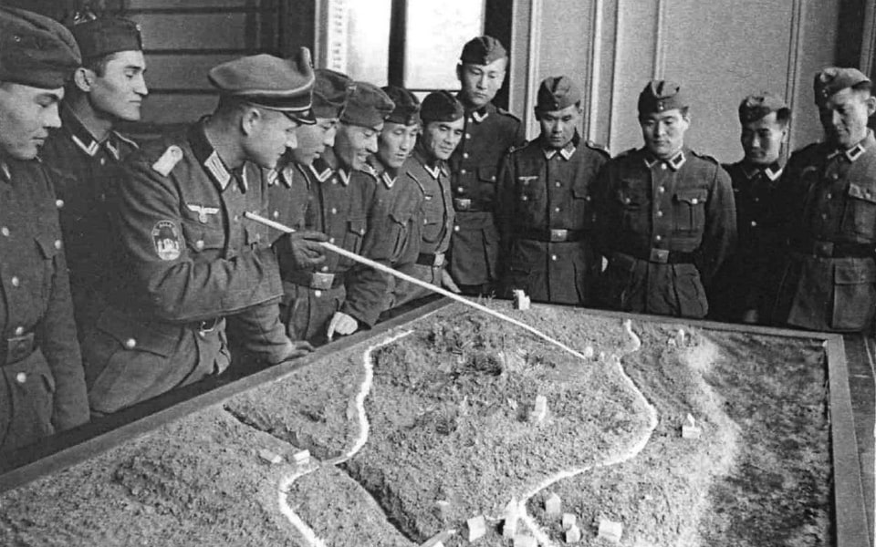
When Field Marshal Erwin Rommel visited the disposition of the division on January 29, 1944, four months before the Allied invasion, he was disappointed that the overextended and mixed Infantry division defended such an important sector. While the division lacked battle experience since its formation back in 1941, it went through three years of training and preparations under the supervision of experienced veterans, officers, and NCOs. In addition, being stationed in Normandy for so long with extensive anti-invasion preparations meant that the men from the 716th Infantry Division had excellent orientation on the terrain and polished coastal defensive means. When D-Day came, it was not their training, but the lack of men, resources, weapons, air support, and reinforcements, that predetermined their destiny facing the Allied armada. For example, in Saint-Laurent-sur-Mer, there were only about one hundred men, mostly young recruits.

The Regiment that would be mainly responsible for the landing sector, later known as Omaha Beach, was the Grenadier-Regiment 726. Formed in October 1942, it was a well-trained formation that expertly knew its sector of defense. In April 1944, the regiment was reinforced with the so-called Ost-Batallion 439. While the attached non-German unit was of doubtful quality, the core personnel of the regiment were well-placed and showed mastery in the defense preparations. As an example, they used to mark the beach obstacles with colored fabric pieces to adjust machine guns and cannons for more precise fire against the potential enemy. In general, the men from the 716th Infantry Division laid up to 100,000 mines within their sector, and on the day of the invasion, the Omaha beach sector was protected by 3,700 different obstacles, including 2000 wooden stakes, 1,050 so-called Czech Hedgehogs, 450 ramps, and 200 so-called Belgian gates. The latter comprised the first line of defense, the farthest from the coast at 800 meters from the high-tide mark. The units of the 716th, divided into small detachments, installed machine gun emplacements and strongholds above the cliffs and relied not only on man-made obstacles but on the terrain.


Two battalions from the 716th Infantry Division were the primary force assigned to protect the coast on the stretch from Vierville-sur-Mer to Cabourg. Stationed in the bunkers and trenches on the coast, they were reinforced by the men from Grenadier-Regiment 914 and Grenadier-Regiment 916 of the 352nd Infantry Division. In contrast to its army sister, the 352nd. was formed as late as November 1943 in France, but was not supposed to stay here constantly, but to be trained and then transferred as a reinforcement to the Eastern Front. Despite common mistakes, the 352nd Infantry Division was not a battle-hardened unit made of veterans. Its personnel had a mixed origin. On the other hand, it was created from the parts of the decimated formations from the East, but most of the division’s men were young German conscripts between eighteen and twenty years old. At least half of its officers lacked combat experience, and the shortage of non-commissioned officers was palpable. One of the company’s commanders called the division ‘a mob’. Now squeezed between the 709th and 716th divisions, the 352nd was meant to hold a stretch of the front in Normandy 53 kilometers long and 34 km deep, which, considering its lack of resources and equipment, was a grotesque mission. The division, which was regarded as mobile, lacked mechanization and partly relied on civilian vehicle drivers from the local French.

With 53 kilometers of coastline in their zone of responsibility in Normandy, the stretch of the future Omaha beach was assigned to two regiments: Grenadier-Regiments 914 and 916. The latter had to assist the 716th Division in defending a sector 25 kilometers long stretching from Grandcamp-les-Bains, through the cliffs at Pointe-du-Hoc, to Verville, St.-Laurent-sur-Mer, to Port-en-Bessin. In May 1944, these two regiments were brought forward to the coastline from their training area and stationed partly in the civilian houses near the beaches, since the Germans lacked barracks near the coastline. On D-day, the 352 Division had from 800 to 1000 men in the Omaha beach area, of which half were stationed in strongholds and defensive nests, and the remaining were positioned in the immediate vicinity. The German forces stationed in or near Saint-Laurent-sur-Mer were of the 10th Company, Grenadier-Regiment 726, 716 Infantry Division, and of the 5th Company, Grenadier-Regiment 916, 352 Infantry Division. Several hundred men were regarded as reinforcements in the vicinity of the coast and ready to reach the beaches upon alert. Others, who would later join the fight at the Omaha sector, were a tank company and divisional engineers. The Allied pre-invasion intelligence did not grasp the level of presence of the 352 Division near the coast, and on June 4, they considered them to be stationed around St-Lo.

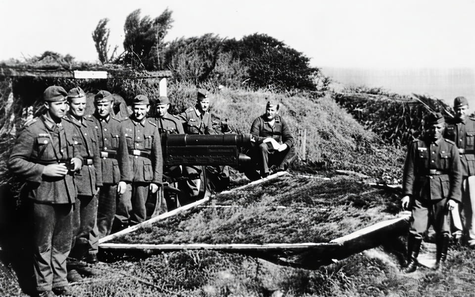
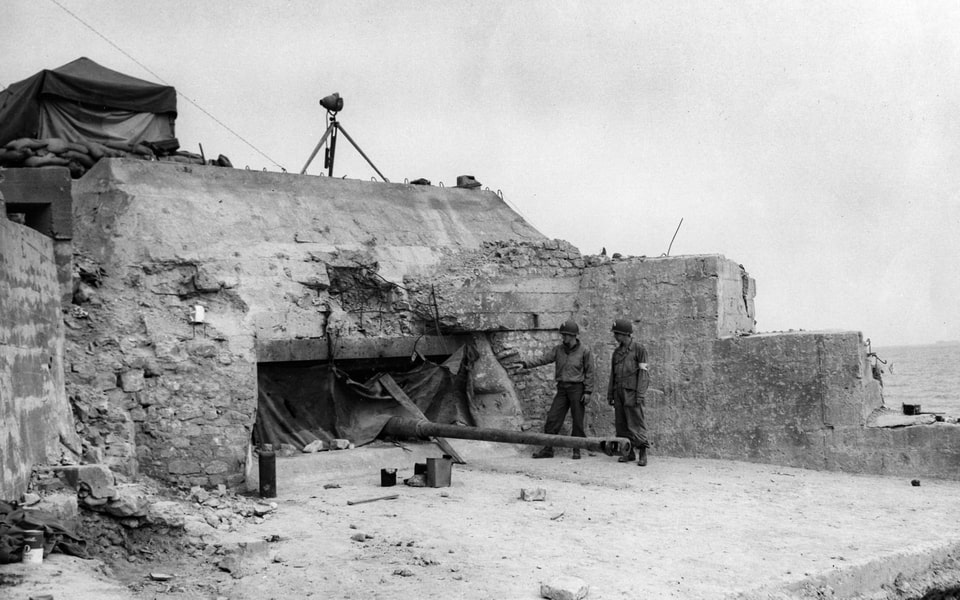
The system of coastal defense in Normandy mainly relied on a network of reinforced bunkers known as Widerstandsnests or simply WN. The stretch of the front between Sainte-Honorine-des-Pertes in the East and Vierville in the West was defended by fifteen such strongpoints, numbered from 59 to 73 respectively. In total, 360 men were stationed in these resistance nests overlooking the beaches from the high cliffs, in total armed with sixty-five machine guns. Unfortunately for the defenders, they lacked heavy anti-aircraft installations except for 20-mm anti-aircraft guns. Like many other aspects of the German defense in Normandy, the armaments inside the WN bunkers at Omaha were not standardized. Among the cannons were 88 mm guns (WN 61 and 71), 76.5 mm guns, 50 mm French Renault tank turrets, 50 mm anti-tank guns, etc. Among the oldest weaponry was a trophy Belgian Canon de 75 mle TR, a 1905 model, renamed by the Germans 75mm FK 235(b). Some possessed flamethrowers and 50 mm grenade launchers; each of them included machine guns: German MG 34, MG 42, and Polish samples. An anti-tank ditch was dug in front of each bunker, with a dense minefield and rows of barbed wire protecting defensive nests themselves made of extra-proof ferroconcrete and steel rods. Zigzagging trenches between weapon emplacements made WN a hell of a challenge to seize.


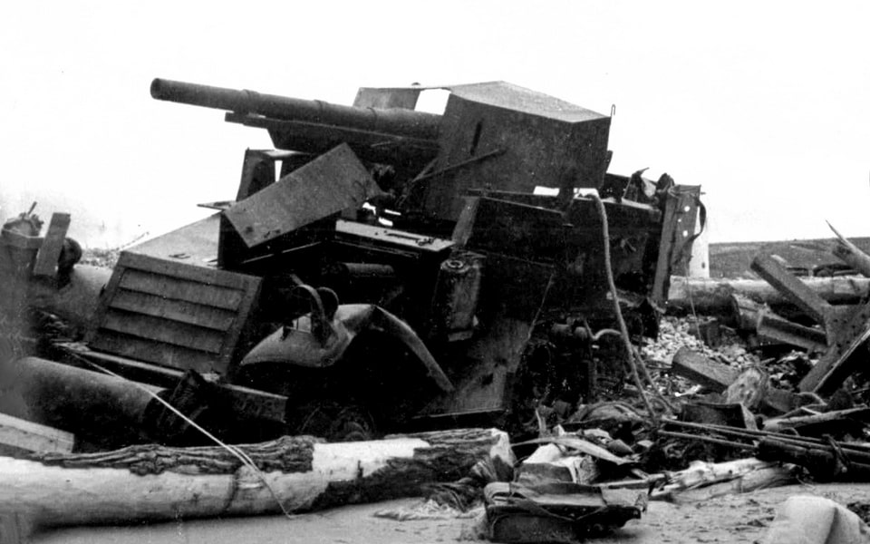
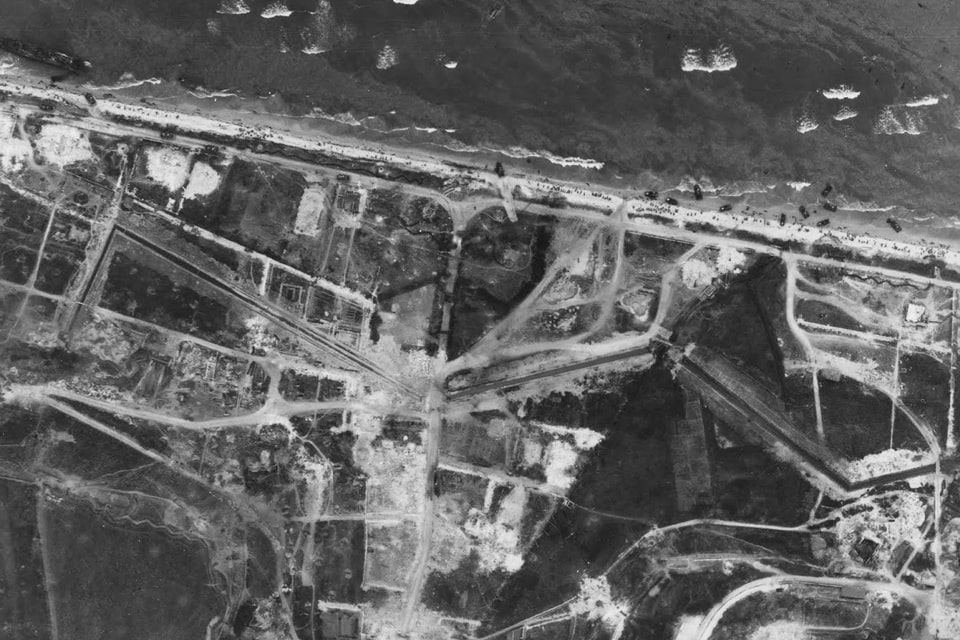
As I stated above, there were five draws or alleys in the Omaha sector, designated routes to leave the beaches and go inland. D-1 or ‘Vierville draw’ was a passage just in front of the village of Vierville, and this entrance was protected by a pair of bunkers from both sides: WN 71 and 72. Further East was the so-called Les Moulins D-3 draw opposite Sainte-Laurent-sur-Mer, protected by WN66 and WN68, and an enormous 600-meter-long anti-tank trench and an anti-tank wall. The next E-1 valley was further along the coast, also near St-Laurent, known as Saint-Laurent draw or Le Ruquet, guarded by WN 64 and 65 and two additional gun casemates with 50 mm pedestal guns. The WN65 would later be well recognized after D-Day and used as a US commanding post. The fourth entrance in the sector codenamed E-3 Colleville draw was protected by WN 61 and 62, placed on both sides of a 500-meter-long trench. Finally, the most eastern valley, F-1 Cabourg draw, was reinforced by one WN 60 defensive nest, with two Belgian Canon de 75 mle TR, and a 200 mm flak gun, but the cliffs here served as a natural barrier to the potential movement of enemy vehicles. WN 60 was filled with forty men under the command of Sergeant Eberhardt. The Germans razed some French buildings near the coast to improve defensive positions. Five potential entrances to the inland for the invading forces of the US 1st and 29th Divisions lay on a stretch of coast 6 kilometers wide with cliffs up to 50 meters high.
THE LANDINGS ON OMAHA BEACH: Dog Green to Fox Red Sectors, June 6, 1944
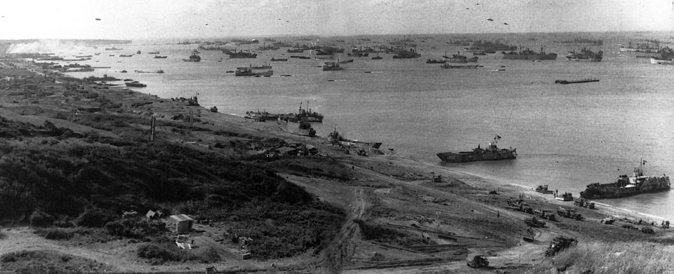
Apart from the men who were assigned to get ashore, the ‘Task Force O ’ of the first wave at Omaha also included large ships, whose task was to ensure the smooth landing process, including the pre-invasion shelling of the German defensive positions on the beaches and inland. Among the ships was a giant USS Texas 175 meters long, which participated in Operation Torch in 1942 and, before Overlord, served as a convoy ship. Her armament allowed her to target several different areas on the shore with different types of guns simultaneously. When USS Texas opened fire on D-Day at 5:50 a.m., the ship targeted German positions at Pointe-du-Hoc and, in parallel, fired at the area of D-1 draw near Vierville. Later on, the ship shifted its shelling focus further inland to hit enemy positions, ensuring against enemy reinforcements to Omaha Beach. Another battleship on D-Day near Omaha was the USS Nevada. The Battleship was damaged during the infamous Japanese attack on Pearl Harbor on December 7, 1941, and it spent almost a year and a half in repair and modernization. Nevada supported the invading forces on D-Day and was the only ship that was both in Pearl Harbor and Normandy.
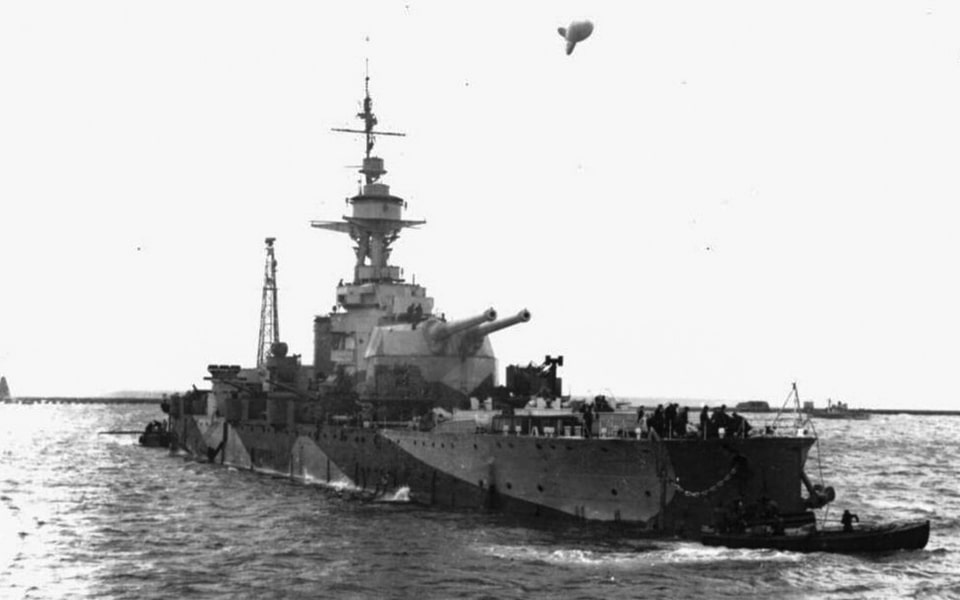
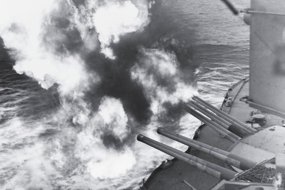
Apart from two US battleships, Task Force O included the British monitor ship HMS Erebus, four cruisers, two of which were French, Georges Leygues and Montcalm, and twelve destroyers. It must be said that the French seamen were frustrated with the idea of shelling their homeland, but they followed the orders of Forces Navales Françaises Libres (FNFL) or ‘Free French Naval Forces’ and of Allied command. The might of Task Force guns rained down on the German coastal defense line around 5.10 on June 6 and continued throughout the whole of D-Day. The naval fire was not the only means for suppressing the enemy’s defensive capabilities. 446 heavy bombers B-24 Liberator were tasked to unload their bombs along the six-kilometer strip of Omaha sector (1,350 B-17 and B-24 in total for five beaches), but due to heavy cloud on that morning and safety measures not to damage Allied ships in front of the shore, most of the bombs were dropped with a delay and they landed further inland, missing their primary targets along the shore. What was planned as 4 tonnes of bombs on every German soldier at Omaha caused almost no damage to the defensive forces on D-Day.

Hours before the first landing craft reached the sand, the American airborne divisions had already come down inland to seal off the beachhead from the west. The most famous of those drop zones was around Sainte-Mère-Église, the first French town liberated on D-Day, where paratroopers of the 82nd Airborne landed in the middle of a burning village.
Getting back to the situation on the ground, the Germans at Omaha were put on alert hours before the first shells or air bombs fell on their positions and before any silhouettes of the landing ships became recognizable in the night air. The LXXXIV (84) Corps received first messages about the landing of enemy paratroopers in Calvados and on the Cotentin peninsula around 1 a.m. and alerted their divisions in the area, particularly the 352nd under the command of Generalmajor Dietrich Kraiss (1889-1944) and the 716th under William Richter (1892-1971). Their division headquarters in Le-Molay-Littry and Caen, respectively, passed the orders to their field positions around 01:00 a.m, and Alarm Level II was announced. The second line forces had to move forward toward the beaches, including the American Omaha sector. While the 716th was a bodenständig (static) formation, it was primarily the 352nd that came into motion. In a narrow sense, the units from the 352nd who had been previously stationed in the villages behind Omaha now got momentum and moved toward the first line of defense. The first reports of the enemy ships in the sea came around 3 a.m. from Port-en-Bessin.

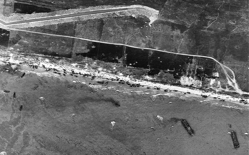
At the same time as the German units on the shore were put on alert, the landing ships of Task Force O came to a stop around 23 kilometers from Omaha Beach. As was stated above, the naval shelling of the sector began at 5.10 a.m., and the first troops that moved forward on land were the men from the 741st Tank Battalion, one of five independent tank battalions that participated in the D-Day in Normandy, now attached to support the 16th Infantry Regiments of the US 1st Division. The unit was formed in March 1942, went through extensive preparations for more than two years, and saw its first fighting around 5.30 a.m. on June 6, 1944. Of the twenty-nine Sherman tanks belonging to the battalion companies B and C heading toward Easy Red and Fox Green sectors near Colleville (E-1 and E-3 draws), only three tanks reached the shore (the alternative sources state five out of thirty-two). The sister 743rd Tank Battalion, heading Dog Green and Dog white sectors opposite Vierville (D-3 Draw), supporting the 116th Regiment of the 29th Division, also suffered heavy losses at the initial phase, losing half of its tanks and all officers.
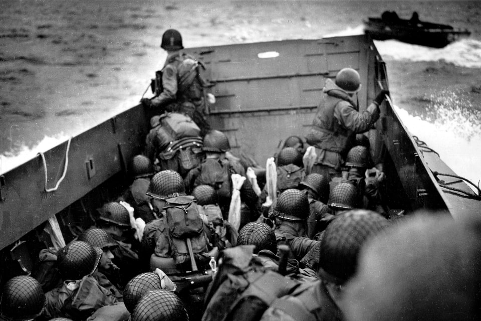

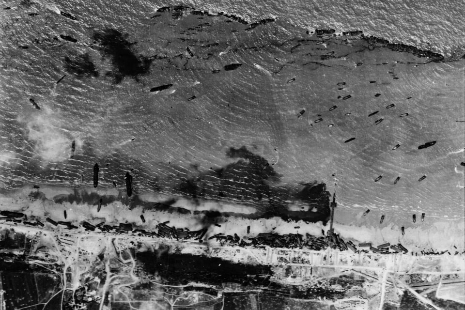
Speaking about the first hours of American landing efforts at Omaha in the early hours of June 6, the coming forces were visible from the German WN defensive nests and thus exposed to the dense enemy fire on their way to the beach, then in the death line between the water and the footing of the cliffs. As a result, the vanguard units had no alternative but to cover over four hundred meters in the open with beach obstacles as the only means to take cover. After covering the distance toward the potential exits from the beach (draws), the American soldiers faced long anti-tank ditches, a dense network of barbed wire,e and more obstacles, minefields, and even remote-controlled flamethrowers while approaching the fortified defensive positions hidden behind the ferroconcrete. The nature of the WN installations and the surrounding trenches made them unapproachable for flanking attacks. The double nature of the fourth entrances, except for a single WN-60, created a situation of crossfire against the enemy troops who tried to infiltrate the draws.
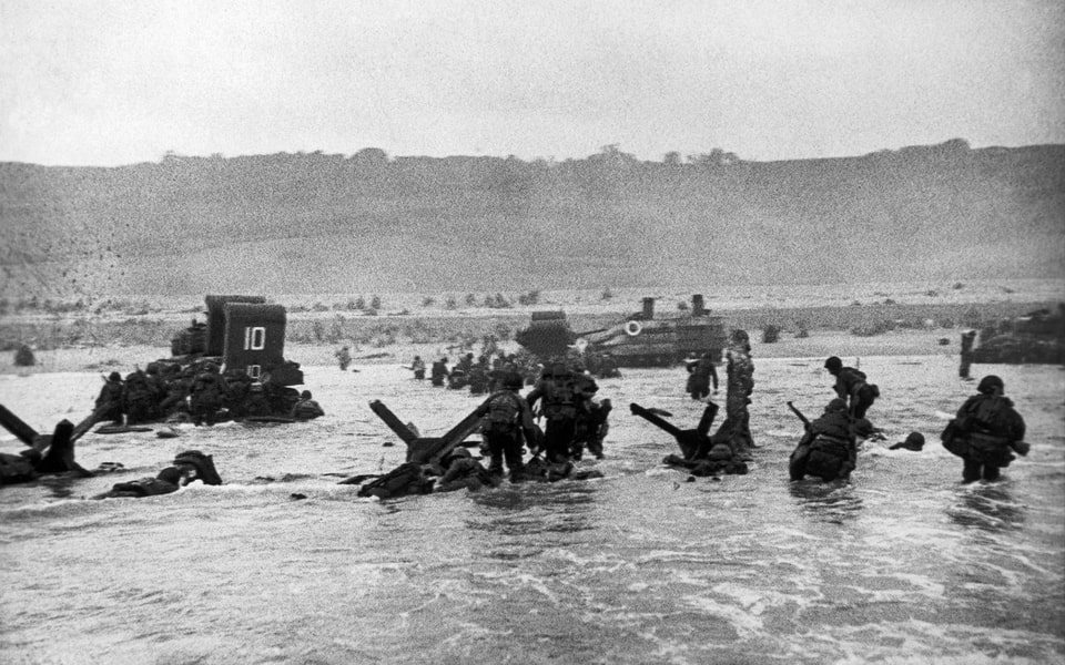

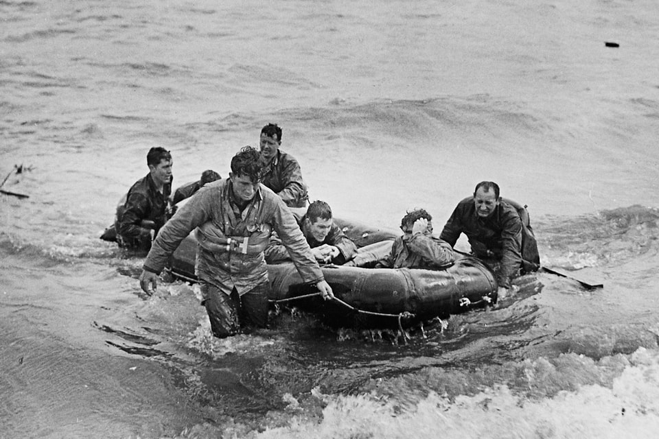
It is not ethical to compare the deadliest places at Omaha Beach on D-Day, as every soldier faced enormous tasks, pressure, and most of them a heavy load of enemy bullets. Probably the heaviest casualties in the first wave were suffered by Company A, 1st Battalion, 116th Regiment, 29th Division. This unit was assigned to land opposite the D-1 Vierville draw at the Dog Green sector on the Western flank of Omaha. The landing crafts became exposed to heavy fire from 50mm guns on their way to the shore, and after disembarkment, the troops of Company A were attacked by a dense crossfire from WN 71, 72, and 73 bunkers above the Vierville draw. Only ten minutes after the landing began, the unit lost its officers and capability of organized action, and lost one-third of its manpower even before Company B joined its effort. Company A suffered the highest casualty rate of any other American unit on D-Day, with more than one hundred men killed in the early hours of June 6, and 212 out of 230 became casualties in one way or another by the end of D-Day. It was this sector and the fight for the Vierville draw that was depicted in 1998 in the iconic ‘Saving Private Ryan’ by the acclaimed Steven Spielberg.


Another critical sector with high American losses was the Fox Green part of Omaha, where the F and E companies from the 2nd Battalion, 16th Regiment, 1st Infantry Division, were struggling to get ashore and seize the E-3 Collevile draw opposite the WN 61 and WN 62. In several minutes, F company lost half of its men killed or wounded, as well as six officers, turning the unit into a scattered mass of men. One of the surviving Germans in the area later called this episode a slaughter, where the Americans were wiped out even before entering a battle. The fire was so intense and the casualty rate so high that no entrance was created immediately opposite the Colleville draw. Instead, toward 7 a.m., four partial gaps in the obstacles were made slightly West, between E3 and E1, between Saint-Laurent and Collevile, respectively, while the overall casualty rate in the first wave reached forty percent in less than an hour. At that moment, the gaps here were only wide enough to accept a relatively large number of landing troops. By 8.00 a.m., parts of eight companies from the 16th regiment managed to take hold beneath the cliffs between E-1 and E-3 draws.


Some units unintentionally landed away from their designated area because of the tide and waves. For example, two companies from the 3rd Battalion, 16th Regiment reached the shore further east, opposite the F-1 Cabourg draw and the WN-60 defense nest. The less dense fire here and the specifics of the cliffs saved them from being wiped out opposite Collevile. Later on, relatively small casualties allowed the 3rd Battalion to gain momentum to make slow but controlled holes in the German defense. By 10 a.m., the German WN 60, 61, and 62 strongpoints were still holding, but the American units finally found their way behind the enemy lines and bypassed them, with vanguard units already in Colleville. By noon, the men from the 16th Regiment, primarily of its 3rd Battalion mostly suppressed and besieged the three eastern defensive nests (60, 61, and 62), and further west, the German resistance at the E-1 draw also decreased by noon of June 6. At this time, the men from the 115th Regiment, 29th Division landed near St. Laurent-sur-Mer, advanced, bypassing E-1 further inland into the village, and thus also bypassing the D-3 Les Moulins draw. Already in the village, the American soldiers seized the launching site from where the Germans had previously plagued the beaches.
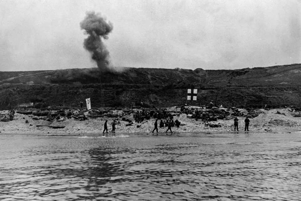


As the first wave succeeded in taking hold at the beaches and penetrating the German defensive lines, the high-ranking US officers joined their forces. Colonel Charles D.W. Canham, the commander of the 116th Infantry Regiment, 29th Division, landed with several companies at the Dog Red sector opposite Saint-Laurent. Graham was wounded in his wrist, but he rejected evacuation and meticulously led his men further inland. General Norman Cota (1893-1971), an assistant division commander of the 29th and one of the masterminds behind the Overlord planning, arrived in the third wave with the men from the 116th Regiment at Dog White sector between Vierville and Saint-Laurent. Around 8 a.m., he led the men from C company through the cliffs and grass to the plateau east of the WN-70 installation. By 4.10 p.m., the German Grenadier Regiment 726, 716th Division, was finally forced to retreat from St.Laurent-sur-Mer, leaving the Germans to set up a new defensive perimeter to the south. The WN-67 and WN-69 inland strongholds were finally secured by the early evening.
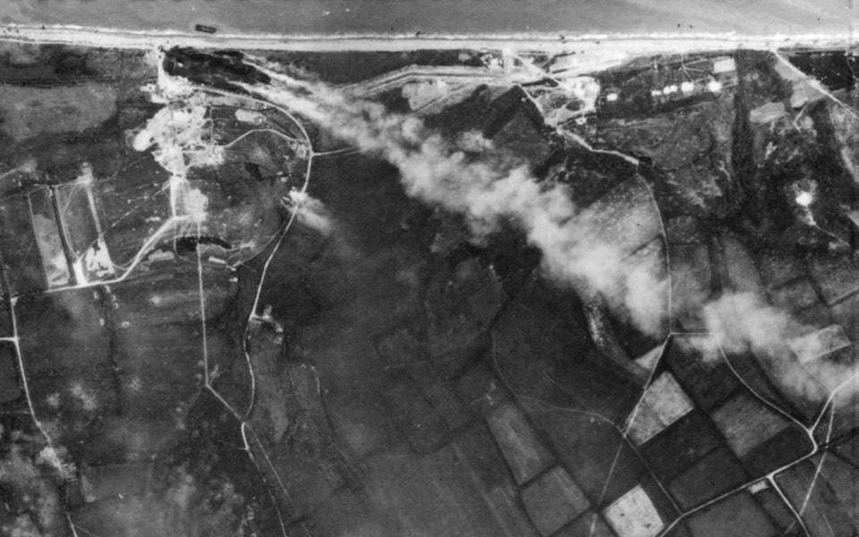


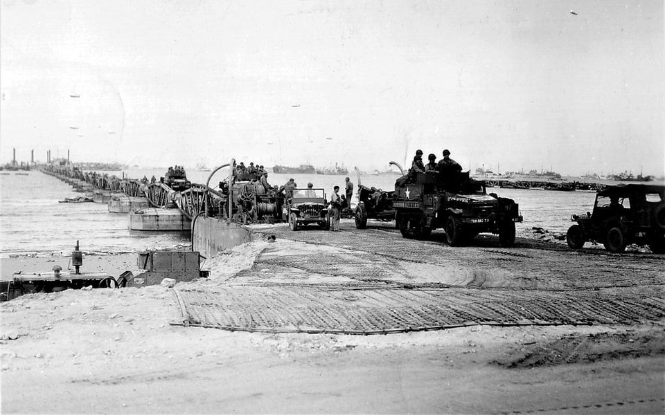
Despite securing all key defensive nests and drawing toward the evening of June 6, the last German forces were forced out of the village of St.Laurent-sur-Mer as late as the next morning, June 7. Around 9 a.m., the area was secured, and the 3rd Battalion, 115th Regiment moved to the west toward Vierville. Of the 2,400 tonnes of supplies planned to be delivered in the Omaha sector on June 6, only one hundred tonnes came. After securing the shoreline at Omaha Beach, a new stage of Overlord began with the building up of several artificial harbors called Mulberry. One of them, known as Mulberry A, was to be created in the area opposite the village of St.Laurent-sur-Mer. In the initial phase, the engineers installed the giant ‘Gooseberry’ breakwater lines near the shores of Normandy, consisting of fifty-five ships, of which twenty-two were British, sixteen American, and seventeen from other nations. Toward D-Day +12 days, both artificial harbors, one near St. Laurent-sur-Mer and the other Mulberry B at the Gold Beach, was put into operation, with a capacity of receiving up to 7000 tonnes of supplies each. Starting from D-Day, Saint-Laurent-sur-Mer also accommodated the 13th Field Hospital. Apart from the sea logistics, the US 834th Engineer Aviation Battalion constructed an emergency landing strip in just three days, and then turned it into a fully-fledged airfield in Normandy, which, among other missions, evacuated up to 15,000 wounded soldiers to England between June 9 and August 25, 1944.

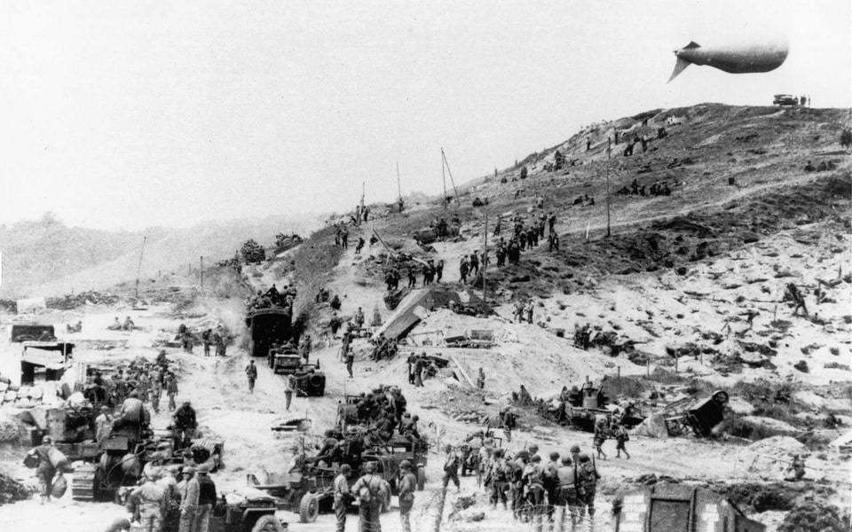
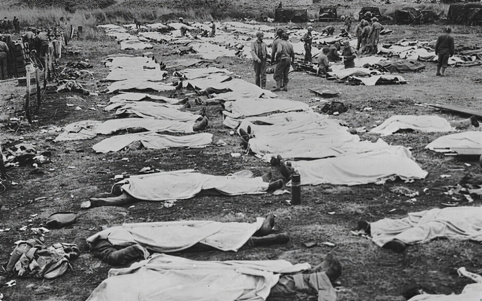
D-Day in Normandy was not the single deadliest day in the Second World War for the United States, overshadowed by the death toll in the Pacific, but the soldiers who survived remembered June 6, 1944, as a grave loss of their combat friends. The most established estimate says that the total Allied casualties on D-Day were 10,250, of which 4,414 were killed, of which 2,400 men were Americans. When dealing with two key Divisions that conquered the Omaha Beach sector, according to the official unit data, the 1st Infantry Division or ‘Big Red One’ suffered a casualty rate of 1,346 on June 6 (however, a later alternative estimate gives 1,174). 971 of 1,346 were the men from the 16th Infantry Regiment, or 72%, of whom 247 were dead.. In total, toward the end of the war, the 29th suffered 20,111 losses in Europe, including 3,720 dead, while the established personnel was 14,000. It should be said that not all casualties were accounted for, especially in the attached units such as the 741, 743, and 745 Tank Battalions, combat engineer battalions, and gap assault teams, landing craft crewmen. In total, the men from the 1st Division received 4,300 combat decorations, Silver Star and higher, and the 29th only around 900, while suffering more casualties in the ETO (European Theater of Operations). The German 352nd Division lost at least 1,200 dead, wounded, missing, or captured on D-Day.

THE POST-WAR COMMEMORATION: American Cemetery, Les Braves Memorial, and the D-Day Sites Today
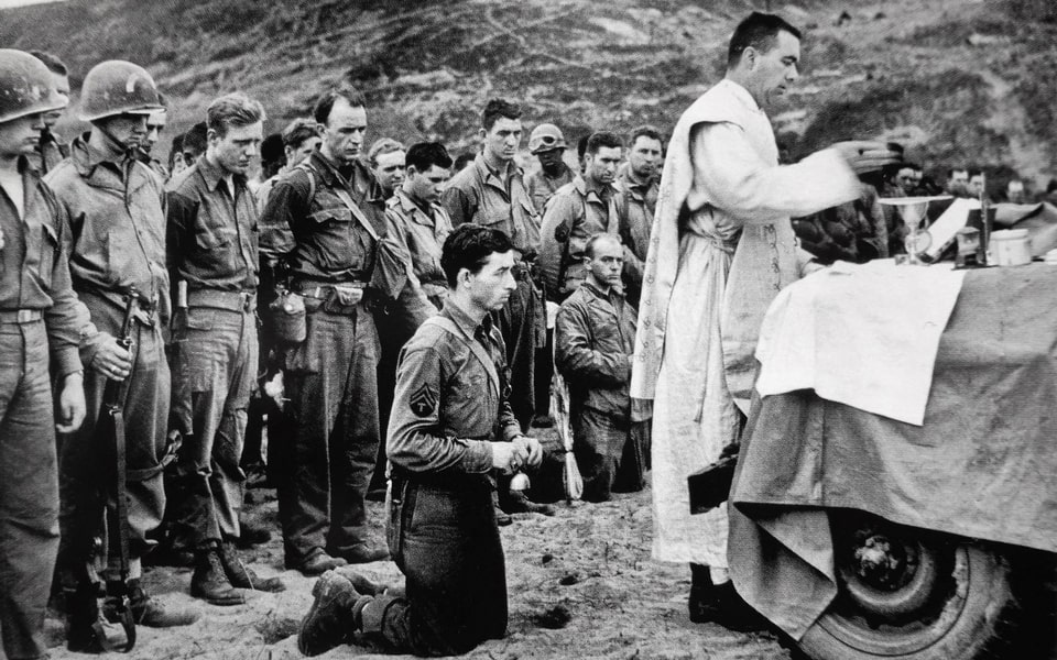
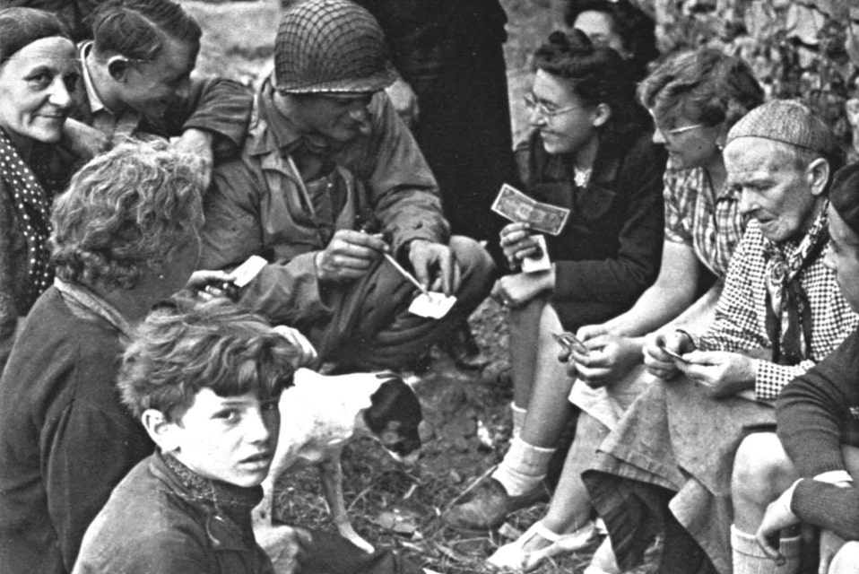
The first years of commemoration of the Normandy landings lacked both the present scale with a diversity of guests among country leaders, and people who came to France very early in June. In the late 1940s, with the very first plaques and stone memorials erected modestly on the beaches, June 6 ceremonies were mainly celebrated by the French population, both the locals and guests from other regions. The former Free France veterans and resistance members, and several hundred people, annually came to the landing beaches, including the Omaha sector. The presence of other Allies, Americans, British, Canadians, and others was on a small scale during the first anniversaries, usually attended by military representatives and ambassadors. Only in 1954, ten years after Overlord, the anniversary ceremonies were attended by the French president René Coty (1882-1962), himself a native of Le Havre, who studied at Caen University. The decision to visit Normandy came in the president’s first year in office, since he was inaugurated in January 1954. While not a hero during WWII, Coty created an important precedent in the D-Day celebrations and put the annual event at a high level of attendance.
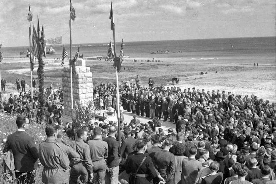
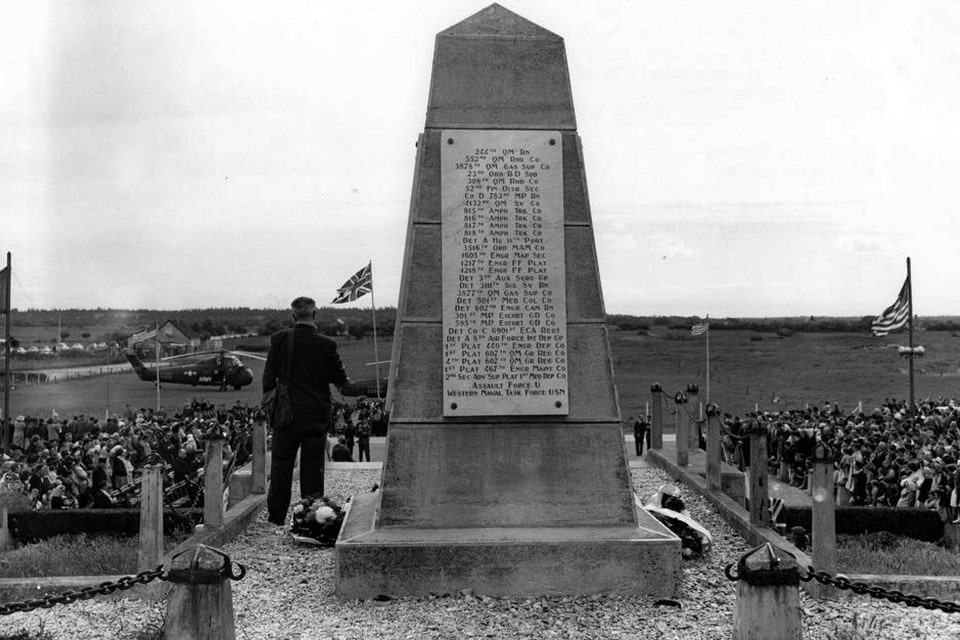
In 1964, the French public opinion was frustrated when their president, Charles de Gaulle, a national WWII hero, ignored the 20th anniversary of Overlord. Being treated not as De Gaulle himself expected during the war by the British and Americans, he was never a big believer in the June 6 commemoration. Instead of visiting the coast of Normandy, De Gaulle attended the anniversary of Allied landings in South France in August 1944, where the French units played a more significant role. Unfortunately for the veterans, the 1974 celebration happened without the presence of another French president, Valery Giscard d’Estaing. The commemoration breakthrough came in 1984 when the ceremonies were attended by US President Ronald Reagan, Queen Elizabeth II, and other heads of state. President Reagan delivered his legendary speech known as ‘The Boys of Pointe Du Hoc’ in front of several hundred Allied veterans. In 1994, the 50th anniversary was attended by a dozen world leaders, including Polish President Lech Walesa, and French President Francois Mitterrand was once again a host during his second term.
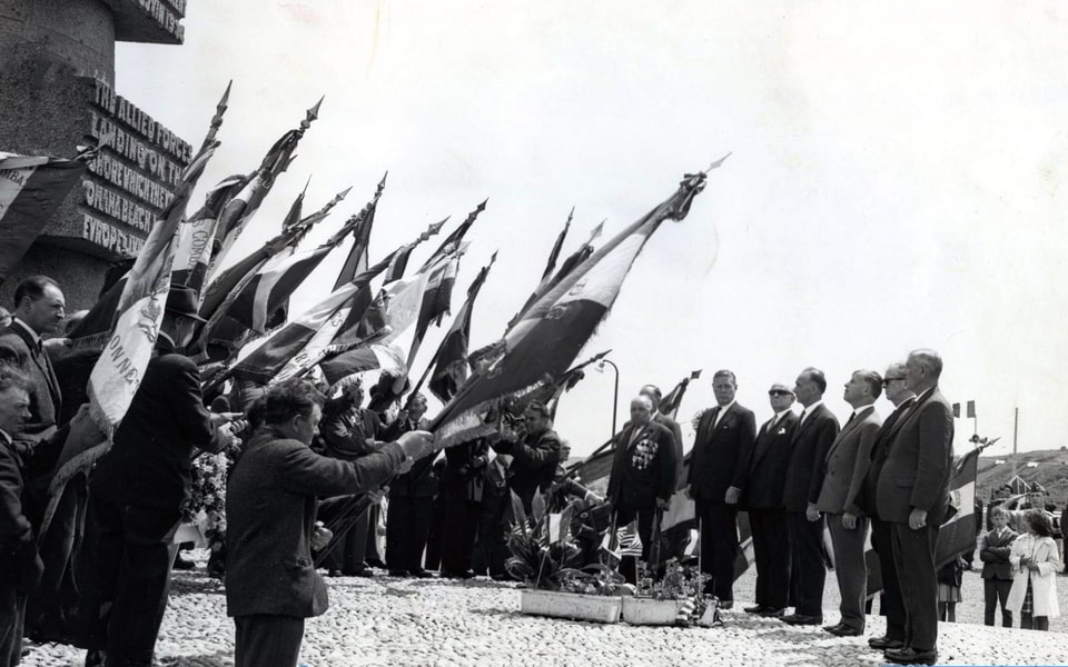
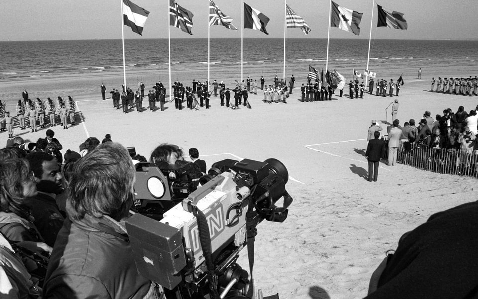
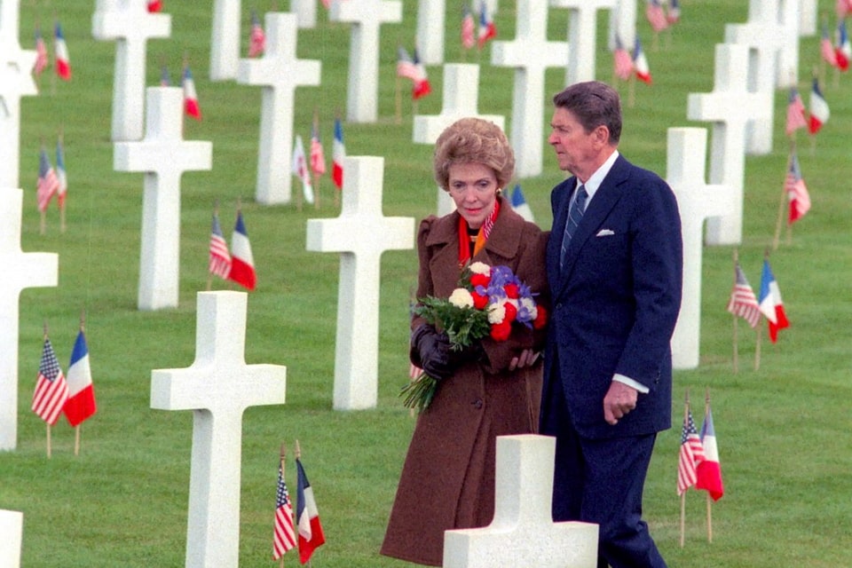
In 2004, the 60th anniversary ceremonies were attended for the first time by a German Chancellor, Gerhard Schroder, at that time, and the russian president, the future war criminal and tyrant, the notorious vladimir putin (neither the dictator nor his people deserve capital letters). Starting in 2004, the annual D-Day celebrations have scaled even more. As late as the 70th anniversary in 2014, in front of twenty-four leaders, French President Francois Hollande finally commemorated the memory of an estimated 20,000 French civilian losses during the Battle of Normandy. In 2024, the russian dictator and a war criminal were declared persona non grata, and Ukrainian President Volodymyr Zelensky was present next to French President Emmanuel Macron, US President Joe Biden, and other world leaders. When speaking about the Saint-Laurent-sur-Mer commune was decorated with the War Cross as far back as 1948.


OMAHA BEACH TODAY: What the Beach Looks Like Now and How to Visit
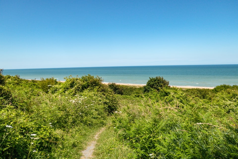
Walking along Omaha Beach today, it is almost impossible to reconcile the peaceful stretch of sand and dune grass with the events of 6 June 1944. The beach is clean, the sea is quiet, and the tourist infrastructure of Saint-Laurent-sur-Mer is visible in the background. What Omaha Beach looks like now is, in many ways, the most powerful part of the story: the silence itself is a kind of answer to the violence of D-Day. The sections below cover the practical aspects of visiting the site — what has been preserved, what the beach looks like across its full five-mile length, and where to find the key memorials, bunkers, and the Normandy American Cemetery overlooking the sea.
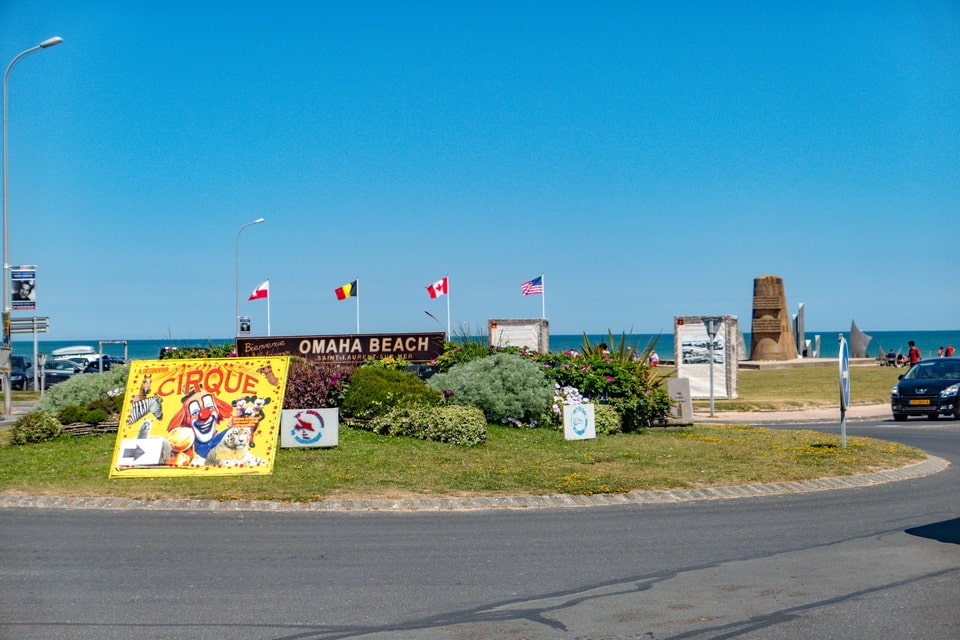
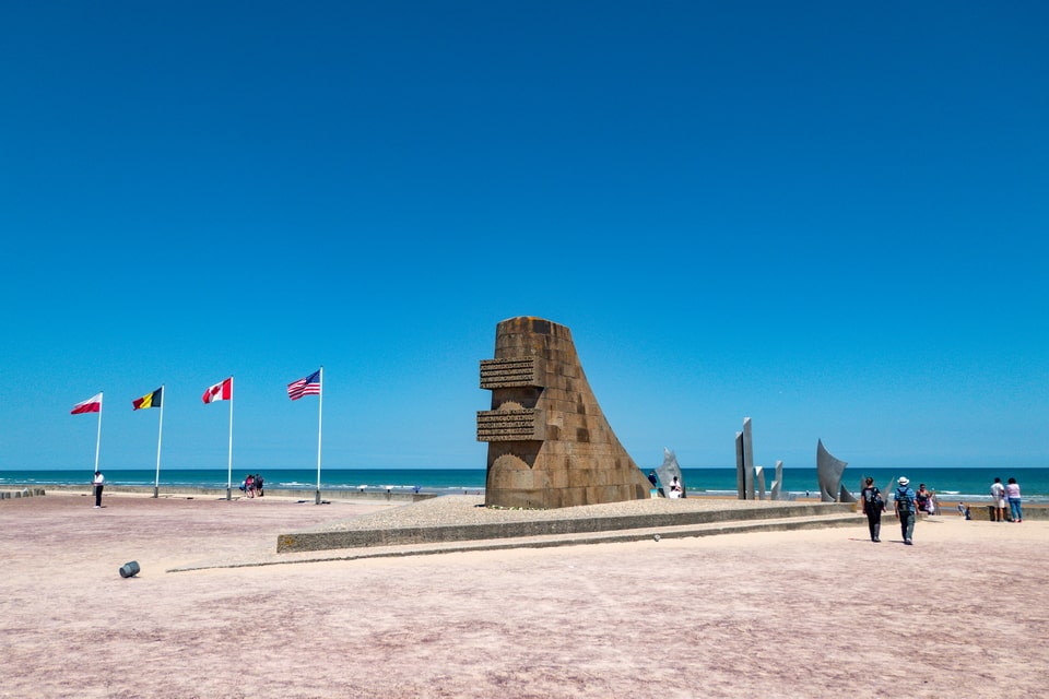
The beach itself: Omaha Beach is a public beach, open and free to visit at all times. The five-mile (eight-kilometre) stretch runs between Vierville-sur-Mer in the west and Colleville-sur-Mer in the east. The sand and dunes are essentially unchanged from 1944 in topography, though the German obstacles and defensive positions are long gone. The most recognisable landmark on the beach is the Les Braves memorial, a stainless-steel sculpture in three parts, installed in 2004 and located in front of the D-Day Museum in Saint-Laurent-sur-Mer. The German bunkers and fortifications on the cliffs above the beach — part of the original Atlantic Wall — remain standing and are accessible on foot.
MUSÉE MÉMORIAL D’OMAHA BEACH AT ST-LAURENT-SUR-MER
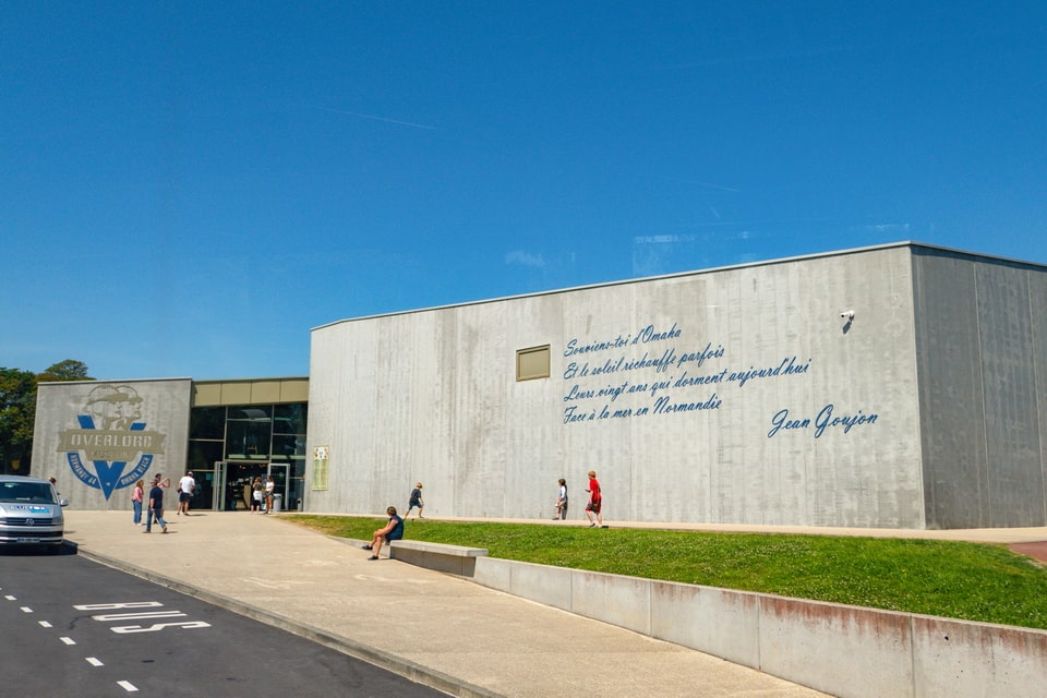
For most of the visitors of Saint-Laurent-sur-Mer, the tour starts with visiting one of the Overlord museums. Almost every commune in the area has its museum devoted to the 1944 Allied landings, but the one in Saint-Laurent-sur-Mer is one of the largest, covering a floor space of 1400 m2. It is located around three hundred meters from the sands of Omaha, just a little inland along Avenue de la Liberation. The museum accommodates an impressive collection of weapons, uniforms, personal items, photos, and even military vehicles that participated in the 1944 landings. One of the highlights of the exhibition is the legendary US tank M4 Sherman, standing in the parking lot in front of the museum.
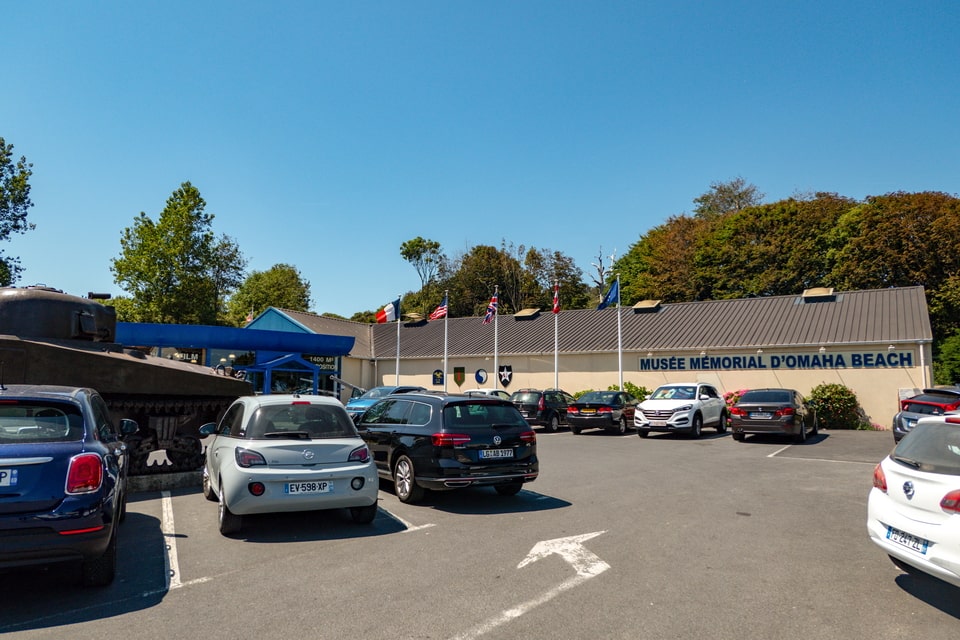
Address: Avenue de la Libération, 14710 Saint-Laurent-sur-Mer
Hours (2026): February–March, October: 10:00–17:30 (last entry 16:30) · April–May, September: 09:30–18:30 (last entry 17:30) · June–August: 09:30–19:00 (last entry 18:00) · Closed 1 November–mid February
Admission: €7.90 adults · Children under 7 free
Note: The museum covers the entire Omaha Beach assault with personal artefacts, uniforms, vehicles, and a film on the landing. Highly recommended before or after walking on the beach.
OMAHA BEACH MEMORIAL
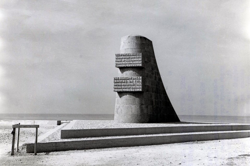
Those who visited the most well-known historical locations in Normandy related to the Allied invasion in 1944 should have seen the old type of memorials, which look like the stern of a ship made of stone with the words of commemoration carved on them. They were the first series of centralized memorials erected in Normandy after the war, and ten stones were inaugurated starting in 1950 and later known as ‘Signal memorials’ or ‘Liberation memorials’. The design was created by French architect Yves-Marie-Froidevaux (1907-1983), and ten memorials of the same size and shape with different inscriptions were erected at Omaha Beach, Utah Beach, Gold Beach, Sword Beach, Juno Beach, Sainte-Mère-Eglise, Carentan, near Pegasus Bridge, and in Isigny-sur-Mer. The one that commemorates the memory of Americans who lost their lives in the Omaha sector was inaugurated on the quay of Saint-Laurent-sur-Mer at the place that in June 1944 was known as the D-3 Les Moulins Draw, squeezed between two defensive nests: WN-66 and 68. On the sides of the stone, some inscriptions commemorate the men from the 1st and 29th Divisions. This particular monument was inaugurated on June 6, 1957.
MONUMENT LES BRAVES
While the Signal memorial was the most well-known commemoration stone in Omaha for decades, the new 21st century brought a series of new memorials, including the one that has overshadowed the work of Yves-Marie-Froidevaux. The 15-meter-wide and 9-meter-high sculpture weighs fifteen tonnes and was inaugurated in 2004 to celebrate the 60th anniversary of the Normandy landings. Created by a female French artist, Anilore Banon (born 1957), the sculpture consists of three groups of metal wings: The Wings of Hope, Freedom, and Fraternity. It commemorates the memory of those who gave their lives to liberate France from the German occupation. The memorial call to change the world for the better, and stand against all forms of inhumanity. In 2023, Les Braves memorial gained its sister sculpture, also created by Anilore Babob in France, delivered to the United States, and inaugurated at the War Memorial in the city of Michigan.
RUQUET CASEMATE: WN-62
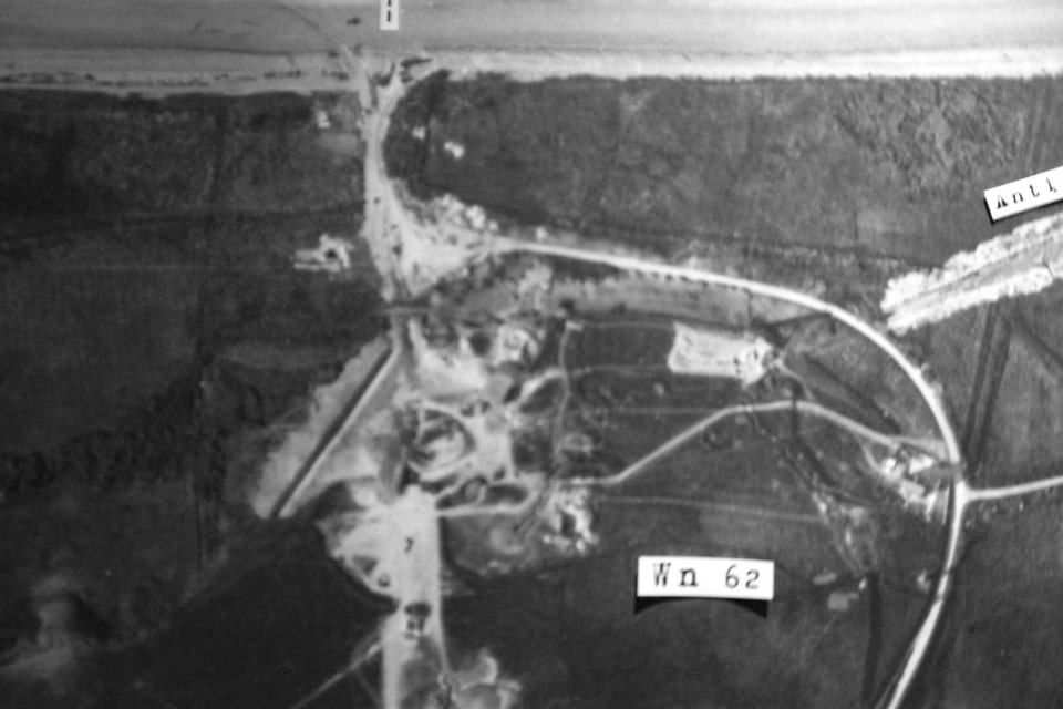
As I stated above, the strip of shore between Vierville and Sainte-Honorine-des-Pertes was protected by fifteen German Widerstandsnests, defensive nests or simply WN. Several of them survived the D-Day invasion relatively undamaged and were later preserved as historical monuments. While WN-65 became famous thanks to accommodating a US commanding post, WN-62 became the most recognized of the fifteen strongpoints thanks to its preserved state, the establishment of a US cemetery nearby, and two German soldiers from this post, who not only survived the war but wrote memoirs about their experience here.
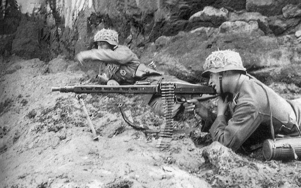
Hein Severloh (1923-2006) wrote a book called ‘WN 62: Erinnerungen an Omaha Beach Normandie, 6. Juni 1944’ (A German Soldier’s Memories of the Defence of Omaha Beach, Normandy, June 6) was published in 2000. Severloh operated the infamous MG-42 gun and later fired against the approaching US soldiers from the 98K rifle, claiming to shoot 12,500 and 400 rounds respectively. He claimed to have made casualties of one thousand to two thousand American soldiers, a highly exaggerated figure. Hein Severloh and several other surviving men from WN-62 left their positions as late as 3.30 p.m., heading toward Colleville-sur-Mer, where he was taken prisoner on June 7. Another German soldier who survived the WN-62 and later told his story to the world was Pvt. Franz Gockel (1925-2005). He wrote a book called ‘Das Tor zur Hölle – Omaha Beach 6 Juni 1944’ (A Road to Hell: Omaha Beach June 6, 1944). Almost every year since the late 1958, he used to come to Normandy for the annual D-Day anniversary.
The WN-62 was claimed to be the most defended strongpoint at Omaha Beach on D-Day. Located approximately 170 meters from the high tide mark, in pair with the sister WN-61 post, it defended the area at least four hundred meters wide and protected the E-3 Collevile draw. Before the spring of 1944, the stronghold was manned primarily by soldiers from the static 716th Infantry Division, from its 3rd company of the Grenadier Regiment 726. Their commanding post with a battalion commander, Major Ernst-August Lohmann, was placed inside the WN-63 bunker, stationed in Colleville, nearly 1400 meters from the shoreline. In the month upcoming to the invasion, the personnel here were backed by the men from the 352 Division. On the morning of June 6, 1944, the WN-62 was protected by twenty-seven men from the 716th Division and thirteen from the 352nd, including Hein Severloh. The men from the 352nd were from Artillery Regiment 352 and Grenadier Regiment 916.

The WN-62 stronghold, like most of his twin defensive nests, was not only a bunker with guns but a densely fortified area, a ring with an 80-meter radius and five hundred meters circumference with concrete fortifications, belts of minefields, lines of barbed wire, and a system of anti-tank ditches, an artillery observation bunker for regulating fire from the inland 105mm batteries. The Germans here possessed two 75-mm Belgian anti-tank guns, one 50mm anti-tank gun, two 50mm mortars, two flamethrowers, several MG-34s for anti-aircraft fire, and MG-42 guns against the enemy infantry. Despite clearing all French buildings along the coast, near the WN-62, an old villa was preserved where the garrison ate and spent time before the invasion. While building up fortifications was sped up after Erwin Rommel inspected the coast in January 1944, on the morning of the invasion on June 6, the fortification works here were not completed, which saved the American troops from even more defended positions. One of the gun bunkers at WN-62 suffered a direct hit early in the morning around 7.45 a.m., the second one was hit around 10 o’clock, and the surviving staff left the defensive nest around 3.30 p.m. Nowadays, the remains of the German defensive positions here are a desired tourist destination.


MEMORIAL TO THE 5TH ENGINEER SPECIAL BRIGADE
This memorial stone with several plaques with inscriptions and commemoration can be found on the top of one of the two former gun casemates of the WN-62 strongpoint, within walking distance from the US cemetery. The 5th Brigade spent months between November 1943 and June 1944 training in England. Its vanguard units landed on the Normandy beaches and Omaha, particularly within the first waves of landing troops in the early morning of June 6. Apart from the acclaimed 5th Brigade, this memorial stone also contains plaques devoted to the 146th Engineer Combat Battalion, 6th Naval Beach Battalion, and 299th Combat Engineers.

OMAHA BEACH CEMETERY
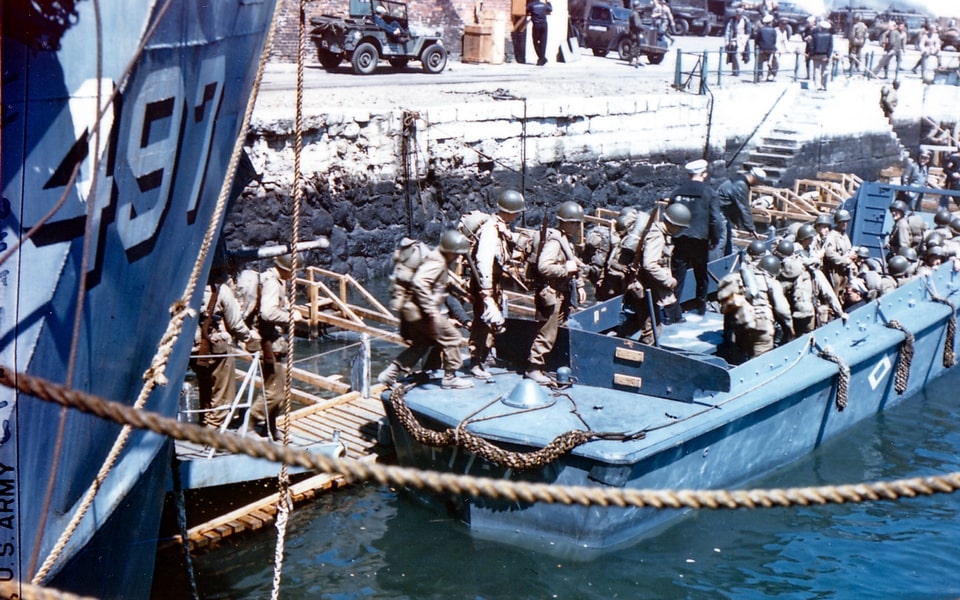
One contemporary estimate gives the figure of 3,881 American soldiers who were killed, wounded, or missing on D-Day in the Omaha sector, and more established sources give 3,686, of whom 777 lost their lives. The first temporary cemetery for the killed soldiers at Omaha was organized between Vierville and St-Laurent-sur-Mer by the 607th Quartermaster Graves Registration Company, assisted by two other companies. They collected the bodies of 457 fallen soldiers, British seamen, and German dead and made burials not far from the shoreline. This was a temporary decision since, as early as June 10, a new main cemetery was opened on the open plateau between Saint-Laurent-sur-Mer and Colleville. It was located in the middle between two beach entrances on D-Day: E-1 and E-3. The first mass burial procedure occurred already on June 1,0, paying tribute to 775 killed Allied soldiers and burying around two hundred Germans. By June 16, 1,510 American soldiers were buried here, as well as 48 Allied and 606 Germans, and the manual work was provided not only by the US engineers but also by enemy prisoners of war. Later in June, another four thousand Americans and Allied soldiers, as well as one and a half thousand Germans, were brought to the cemetery near St-Laurent-sur-Mer.
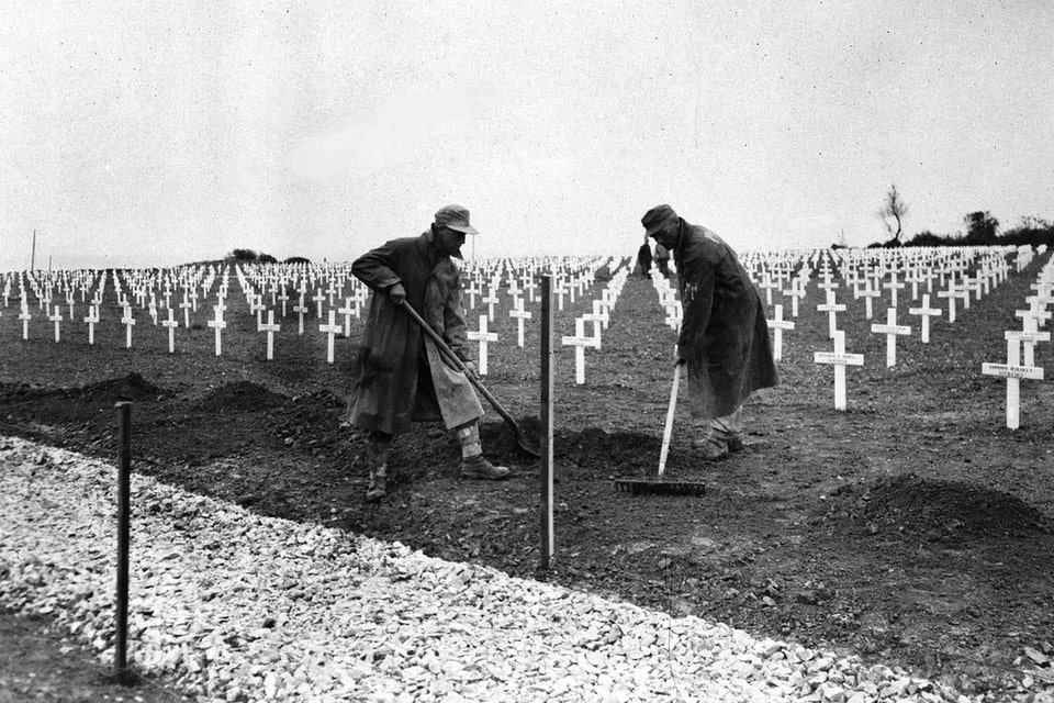
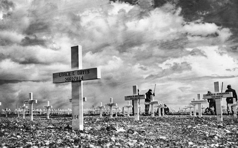
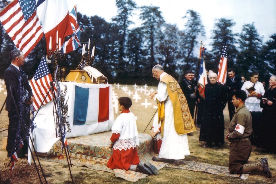
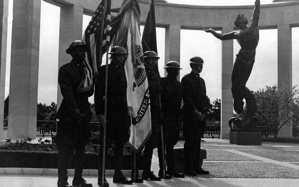
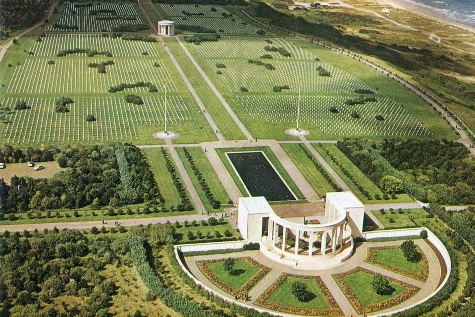
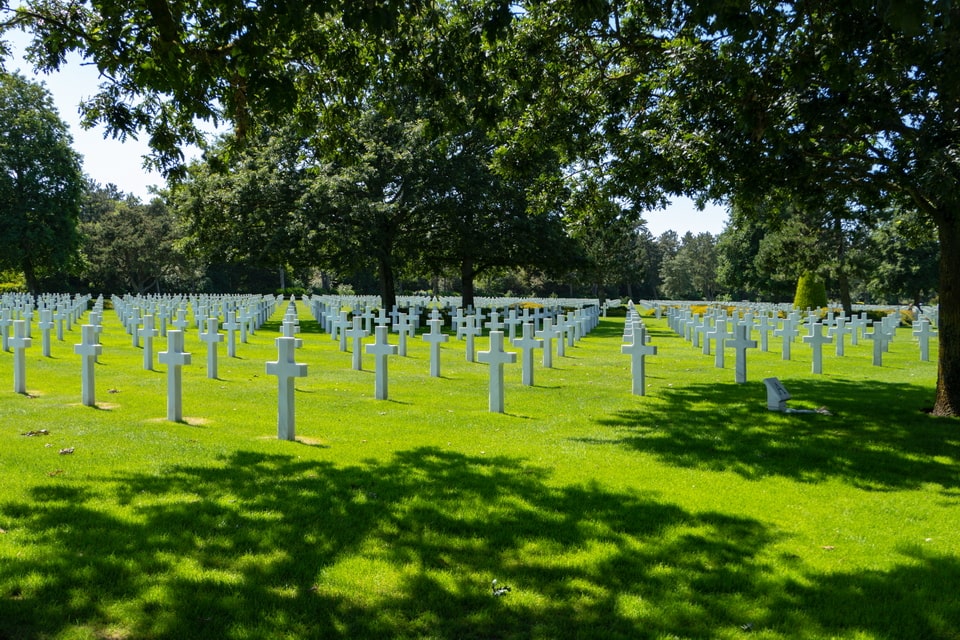
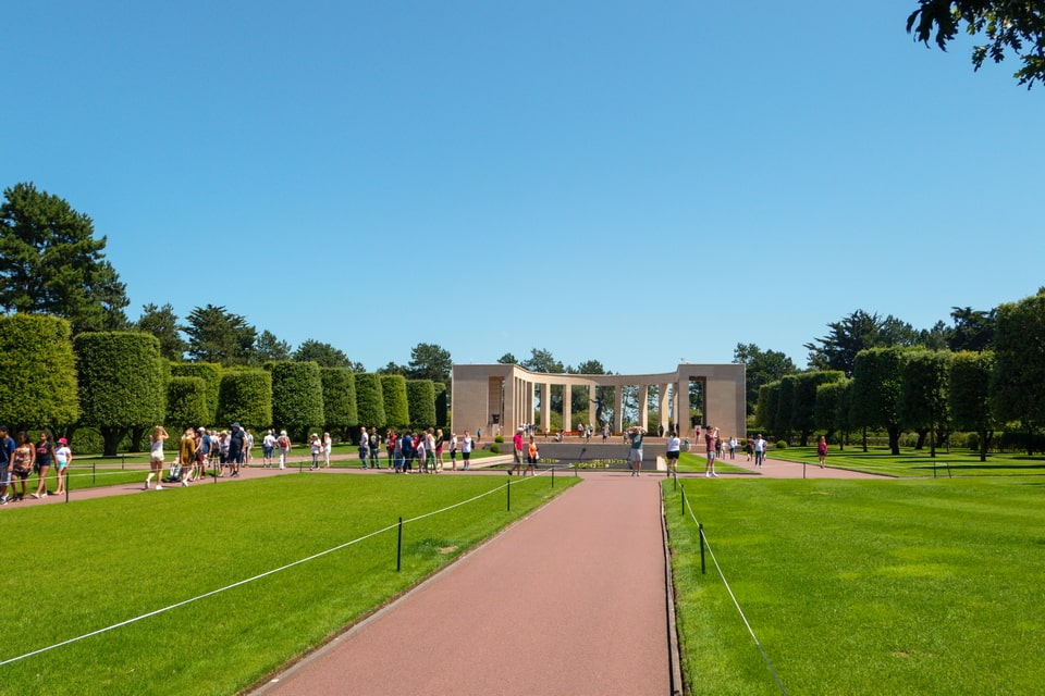
With time, the surface area of the US cemetery rose to 172 acres, and nowadays it dominates the area above the shoreline of the former Omaha Beach. The official record states that 9,387 Allied soldiers were buried here, of whom 307 were unidentified, and four dead were women. Apart from the white crosses for the Christian soldiers (oriented westwards toward the United States) and the Star of David for Jewish soldiers, one of the memorial walls commemorates the names of 1,557 men missing in the battles in this area in 1944. The central composition of the cemetery also welcomes its guests with a bronze statue known as ‘The Spirit of American Youth Rising from the Waves’. The inscription on the statue says: “To these, we owe the high resolve that the cause for which they died shall live.” The territory of the cemetery was granted to the United States by the French government, and it is maintained by the American Battle Monuments Commission, a body operational since 1923.
Address: Colleville-sur-Mer, 14710 · GPS: 49.3611°N, 0.8528°W
Hours: Daily 9:00–17:00 · Closed December 25 and January 1
Admission: Free
Note: The visitor centre includes interactive maps and personal testimonies. Guided tours in English: April–September at 11:00 and 14:00; October–March at 14:00. Plan at least 90 minutes.
I am very grateful to war archives, museums, libraries, private collections, and writers for the historical photos in this article. To the extent that some author or a copyright owner may not want some of the above black-and-white photos to be used for educational purposes here, please contact me for adding credits or deleting the pictures from the article.